
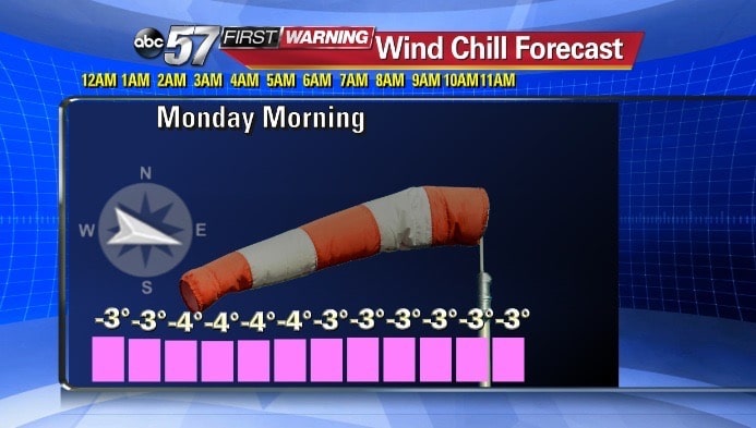
Warmer temperatures that lingered longer than expected resulted in a drastic change for the better in the forecast over the weekend, as the region did not receive the 5“-7” of snow that was expected, but winter weather is still being felt with subzero wind chills now in the region, according to the National Weather Service of Northern Indiana.
Lake effect snow showers will be possible through much of this upcoming week. Snow accumulations of 3 to 5 inches are expected from late Monday through Tuesday.
Wind chills are expected to drop below zero again on Tuesday night.
The ABC 57 First Warning Neighborhood Weather Center Forecast
Wind chills will be below zero overnight into Monday morning. Overnight low, 8°.
Monday: Very cold, highs in the upper teens and low 20s with a chance for snow late in the day.
Tuesday: Lake effect snow, highs in the low 20s.
Wednesday: Highs in the mid to upper teens, lake effect snow continues.