
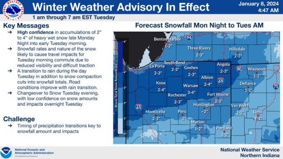
After days of tracking, the winter storm is finally here. Were already in the first phase of this system – wind gusts up to 30mph and heavy, wet snow that could drop up to 2″ of slushy snow before 7AM. The morning commute will be tricky with slushy roads and blowing snow that will reduce visibility.
As temperatures warm through the morning, snow turns to rain which sticks around through the day with breezy conditions persisting. This rain, which is a part of phase 2, along with highs nearing 40 will melt any snow we see from this morning.
Phase 3 of this storm brings the return of wintry mix overnight that will complicate the Wednesday morning commute as well. Winds pick up again as the low-pressure system moves to the northeast, resulting in wind gusts up to 40 mph. We’ll see some light lake effect snow trailing behind the departing system for phase 4 through Wednesday morning before drying out Wednesday afternoon.
Looking ahead, we’re tracking another strong low-pressure system / potential winter storm Friday night into Saturday. We’ll end the weekend with a big drop in temperatures with the possibility of lows nearing zero next week.
Today: Snow to rain, windy. High 40.
Tonight: Rain to snow, windy. Low 33.
Wednesday: AM snow showers. Temperatures falling from 35.
Thursday: Cloudy. High 34.