
The run of very mild weather comes to an end on Friday, Feb. 24.
The changes comes with showers and thunderstorms, possibly severe weather, according to ABC 57 Chief Meteorologist Tom Coomes.
Temperatures will spike once again ahead of a strong cold front that will provide some of the power to the thunderstorms.
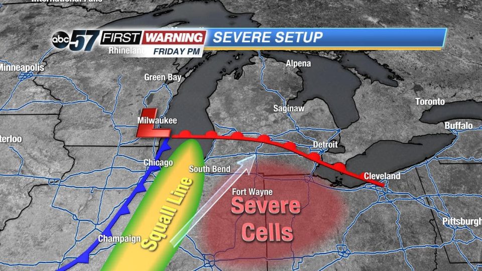
Friday afternoon storm cells will first fire in the mild and relatively humid environment ahead of the cold front. If conditions are right these cells could be strong to severe, Coomes said.
The cells are most likely east of US-31. This area will also have the best chance for hail and tornadoes based on the nature of these storms. The cell threat will be more hit-or-miss, Coomes reported.
By Friday evening a line of thunderstorms could form a squall line. This would bring a more widespread threat for gusty wind and heavy rain. More clouds and rain mid morning to midday would lessen severe risk. More sun and higher temperatures would increase that threat, Coomes reported.
As of Wednesday, there was still low confidence on a widespread severe outbreak. Some may see strong storms, all threats are possible but a large outbreak at this time is unlikely.
The most likely threats to impact the most people would be high wind, in excess of 60 mph and heavy rain. That’s mostly in part to the squall line potential.