
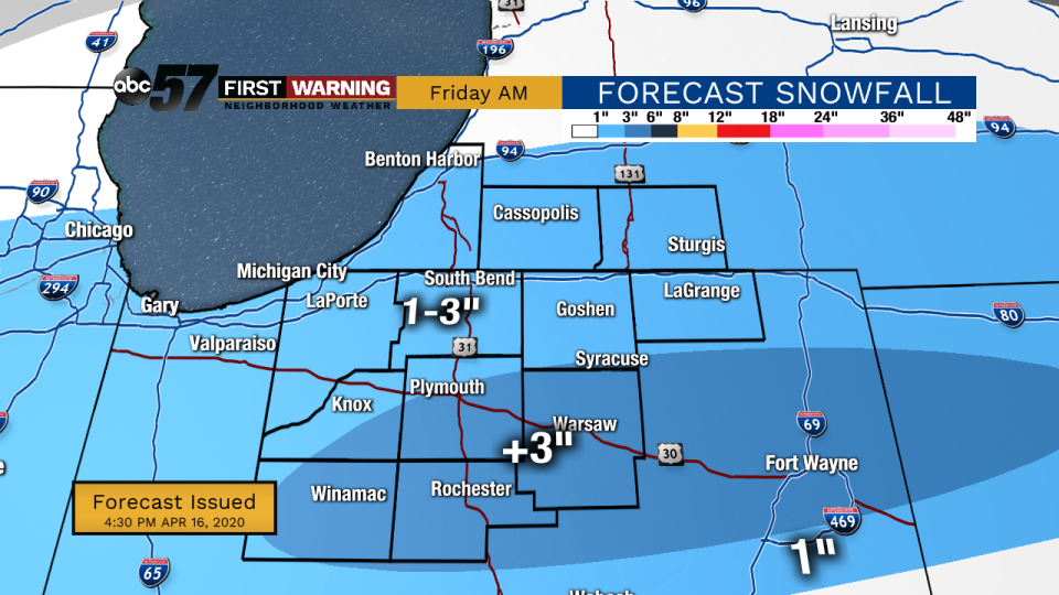
(Tom Coomes/ABC 57 Meteorologist) A burst of snow between 4 a.m. and 12 p.m. on Friday, April 17, will bring a widespread three inches of snow to much of Michiana, with localized higher amounts between Plymouth and Fort Wayne.
This wet spring snow will be at it’s heaviest around 8 a.m. and then transition to a rain/snow mix after 10 a.m.
The snow will mostly accumulate on grass and bare ground but roads may also be coated for a shorter period of time.
Snow gradually melts through Friday afternoon.
The weekend is fair and milder in the mid to lower 50s.
...WINTER WEATHER ADVISORY REMAINS IN EFFECT FROM 5 AM TO 2 PM
EDT FRIDAY...

* WHAT...Snow expected. Total snow accumulations of 3 to 6
  inches.

* WHERE...Portions of northern Indiana and northwest Ohio.

* WHEN...From 5 AM to 2 PM EDT Friday.

* IMPACTS...Plan on slippery road conditions. The hazardous
  conditions could impact the morning commute.

* ADDITIONAL DETAILS...Snow will develop late tonight and persist
  into Friday morning. The snow may be heavy at times, especially
  north of Route 24. Most of the snow accumulation is expected
  from roughly 6 AM to 12 PM EDT Friday. Rain may mix with the
  snow south of Route 24, potentially limiting snow amounts.

PRECAUTIONARY/PREPAREDNESS ACTIONS...

Slow down and use caution while traveling.
Friday: AM snow/mix, mostly cloudy. High 40.
Saturday: Mostly sunny. High of 52.
Sunday: Partly cloudy. High of 50.