
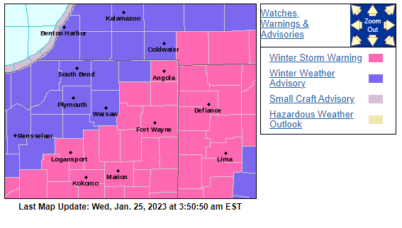
A Winter Weather Advisory remains in effect for the entire MNC listening area through 8 p.m. Areas southeast of Michiana are under a Winter Storm Warning on Wednesday.
CLICK HERE TO CHECK OUT TRAVEL ADVISORIES THROUGHOUT INDIANA
The heaviest snow will start around 11 a.m. on Wednesday, Jan. 25, and last into the early afternoon. Michiana should expect between 1-2 inches during the day with higher totals above 2 inches expected further southeast, especially in Fulton, Kosciusko, and LaGrange Counties.
The most snow from this system should be falling further south and southeast of Michiana,
Fort Wayne will likely see their biggest snow so far this season with more than 6 inches possible.
System snow moves out of our area this evening, but lake effect snow showers will stick with us overnight. Those lake effect showers will be lasting into tomorrow, with more snow to fall in northwestern Michiana. Southwest Michigan and the northernmost counties in Indiana could see up to 2 inches of snow Thursday with more possible in Berrien County.
We round out the week with more, but lighter snow, and snow chances last on-and-off through the weekend.
Snow, heavy at times, will accumulate to several inches by this evening. The heaviest snowfall totals will be in the Interstate 69 and U.S. 24 corridors. pic.twitter.com/JE0WY2ussb
— NWS Northern Indiana (@NWSIWX) January 25, 2023
Your ABC 57 First Warning Neighborhood Weather Center Forecast:
Wednesday: Snow, heavy at times. High 33.
Wednesday Night: Lake effect snow showers. Low 30.
Thursday: Lake effect snow. High 32.
Friday: PM light snow. Breezy. High 34.
1 comment
Mother nature fools us yet again. In Indianapolis we barely got a dusting so far. Good ole Indy weather.