
More clouds move in tonight ahead of our next chance for precipitation – this time as snow – for Sunday.
Sunday morning will bring the first snow showers with the best chance of more steady snowfall in the early afternoon lingering into the evening as a low-pressure system moves through the region.
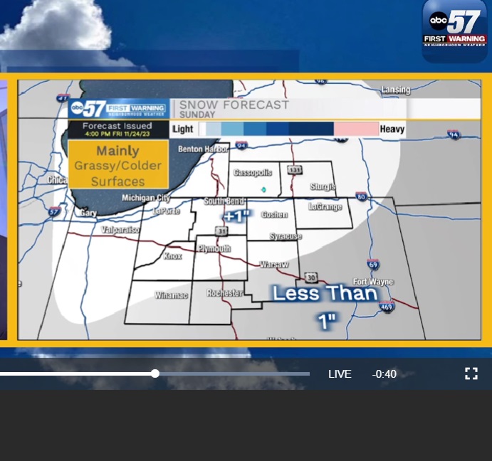
Most of Michiana should pick up around an inch of snow, but more is possible the further north you go, especially in southwest Michigan.
System snow moves out Sunday night, but we could see a few lake-effect flurries Monday, mainly early in the day.
Most of Monday should be dry but cold with highs near freezing.
Once the work week starts, the forecast stays dry but chilly through the end of November.
Your ABC 57 First Warning Neighborhood Weather Center Forecast:
Saturday: Partly cloudy and chilly. High 38.
Sunday: Snow showers. High 35.
Monday: Cloudy and cold. Flurries possible. High 31.
Tuesday: Partly sunny, with a high near 31.
Wednesday: Partly sunny, with a high near 36.
Thursday: Mostly sunny, with a high near 41.
Friday: A chance of showers. Mostly cloudy, with a high near 44.