

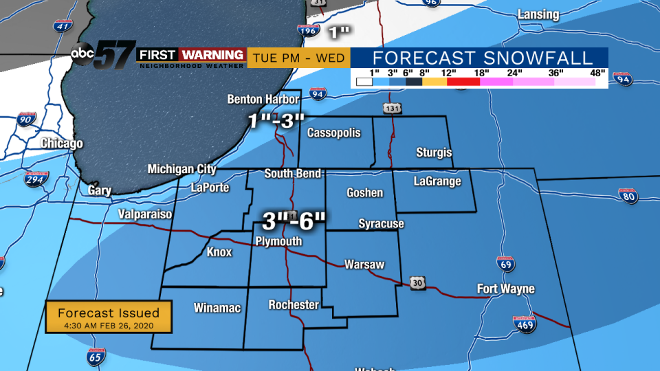
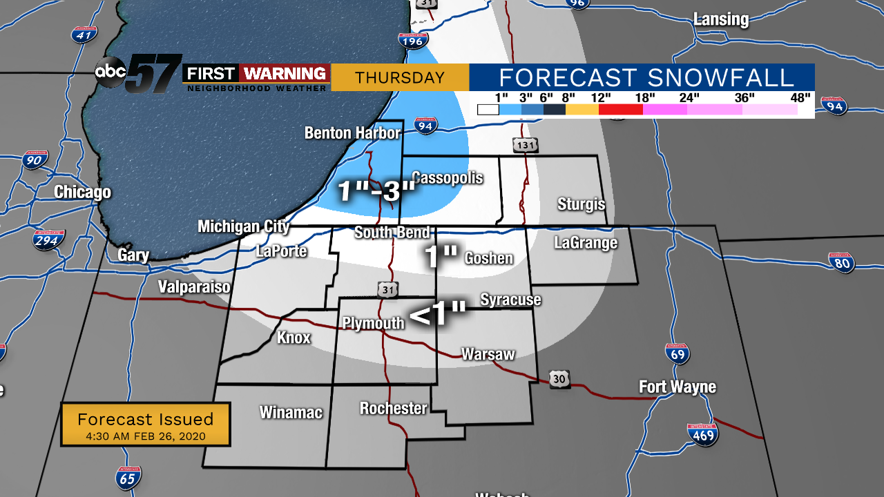
(Emily Kennedy/ABC 57 Meteorologist) Scattered snow showers last into early this evening before moving out. It still looks like most will see 3-6”, many falling closer to the lower end of that range. Lake effect snow then develops tonight into Thursday as cold air rushes in behind the system. A few flurries will likely linger into Friday morning as well.
It’ll be a blustery couple of days, with daytime highs in the mid-20s and wind making it feel even colder. This will create more lakeshore flooding issues along with possible erosion. We’ll start to see more sunshine this weekend with temperatures gradually warming for early next week.
Wednesday: Scattered snow showers. High 31.
Tonight: Lake effect snow possible. Low 20.
Thursday: Lake effect snow, cold and breezy. High 25.
Friday: AM flurries, mostly cloudy. High of 25.
