
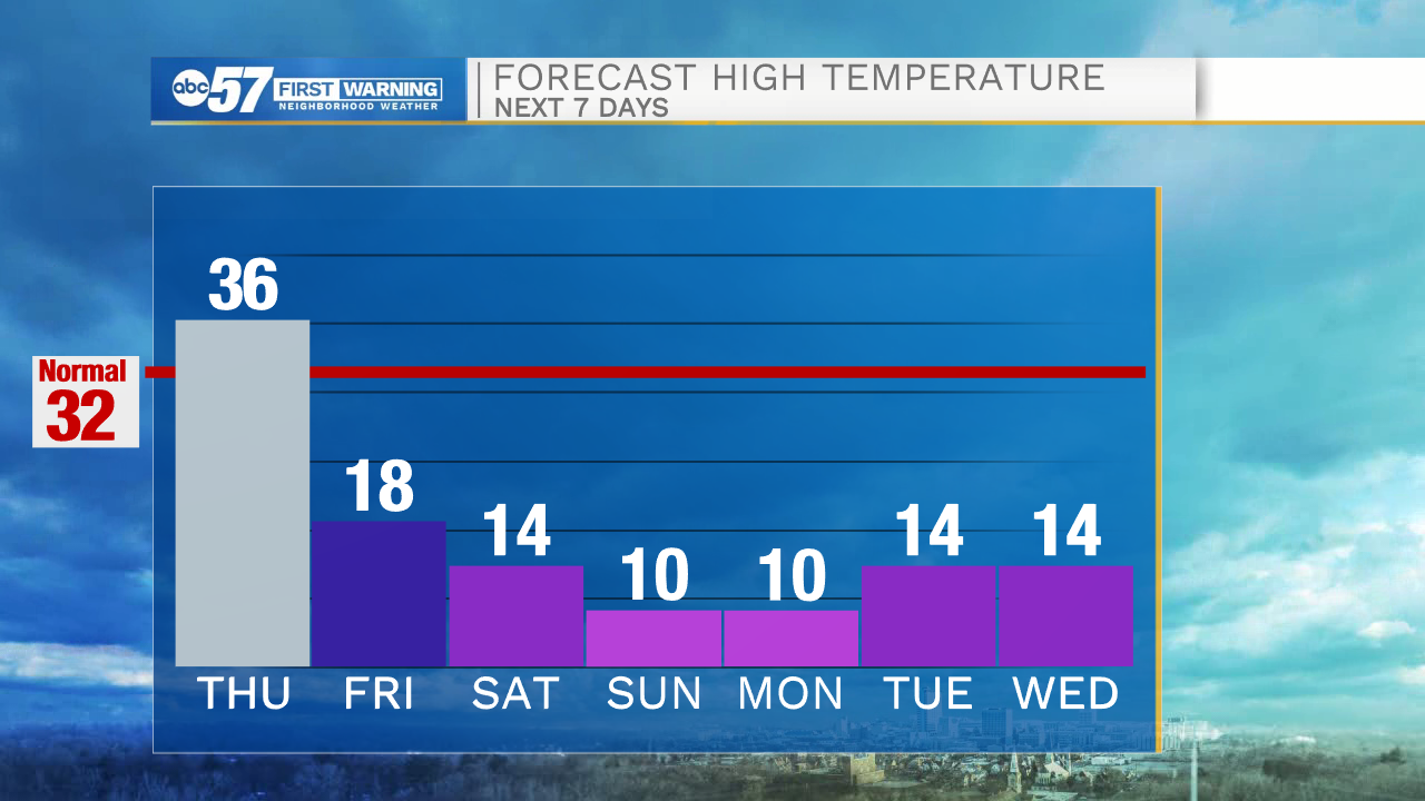
(John Hammersmith/ABC 57 Meteorologist) This afternoon’s temperatures will warm into the mid-30s under mostly cloudy skies. Wind gusts this afternoon will range from 30-35 mph.
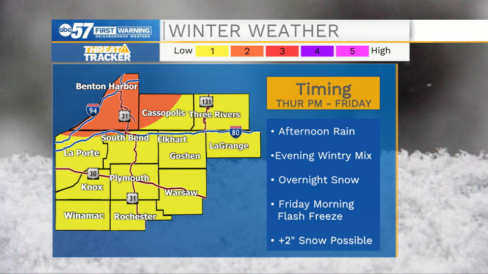
Around 3 p.m. this afternoon a mix of rain and snow will begin. We could see 1-4 inches accumulate into early Friday morning.
The bigger concern will be the falling temperatures during the overnight hours. Temperatures will quickly drop into the teens, causing any wet roadways to flash freeze. Leave extra time for your Friday morning commute.
Lake effect snow showers are possible tomorrow and Saturday, primarily in our northern Michiana counties. More snow will develop and move into Michiana Sunday and Monday night.
Low temperatures next week look to stay in the single digits with high temperatures only hitting the teens.
Your ABC 57 First Warning Neighborhood Weather Center Forecast:
Thursday: Afternoon mixed wintry precip/snow. High 36.
Thursday Night: Snow showers/flash freeze. Low 14.
Friday: Mostly cloudy/snow showers north. High 18.
Saturday: Lake effect snow showers. High 14.