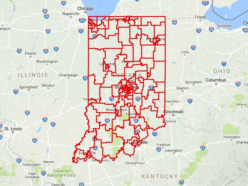
The General Assembly has given final approval to new maps of who represents you there and in Congress.
The bill passed on near party-line votes, 36-12 in the Senate and 64-25 in the House. The new maps will become official once Governor Holcomb signs the bill.
Parts of 26 counties would change congressional districts, as part of the every-10-years rebalancing of district populations. The Republican-drawn maps strengthen the position of suburban Indianapolis Republican Victoria Spartz by slicing Indy’s northside out of her district.
The map pairs incumbents in the same district in six House districts and four Senate districts, creating six open state House districts and four in the Senate. Minutes after the House gave final approval to the maps, International Center vice president Ashley Eason, who lost a race against Senator Jack Sandlin (R-Indianapolis) last year, announced she’ll run for a newly created Democratic-leaning open seat in Indianapolis.
Democrats blasted the maps as designed to lock in the Republican supermajorities, reserving their harshest language for the Senate map, which they described variously as “cruel,” “shameful” and “mean-spirited. Carmel Senator J-D Ford (D) says Republicans “went for the throat” in drawing the new districts. And Ogden Dunes Senator Karen Tallian (D), who announced her retirement on Thursday, charges it virtually wipes out competitive districts. An analysis by I-U-P-U-I student and Democratic activist Nick Roberts calculates the presidential vote was within 10 percentage points in just three of the 50 districts — one of them Tallian’s.
Bedford Senator Eric Koch (cook)(R), who drew the Senate maps, says the 10-year Republican supermajority in the Senate is the result not of biased maps, but the “atrophy” of Indiana’s Democratic Party, especially in southern Indiana. Except for Bloomington’s Shelli Yoder, there are no Democratic senators south of Indianapolis.
Koch says the new maps increase the number of cities, towns and counties kept intact within a single district. Democrats charge there are glaring exceptions designed to lock them out of gaining ground, with a fourth seat carved out of Fort Wayne, a second in Evansville, and Lafayette and West Lafayette split into separate districts.
Three House Republicans who voted against the maps last week voted no again on the final vote, joined in the Senate by retiring Jeffersonville Republican Ron Grooms, whose district vanishes on the new map.
Indiana’s legislature is the fifth to complete redistricting.


2 comments
Nice story. Where is the map????
The Democrats are professionals at using Democrat linked groups to do their bidding, and yet somehow the GOP using a law firm with a former GOP member is scandalous?
Please. Pull the other one, you lying communists