
Strong to severe thunderstorms are possible into Thursday evening.
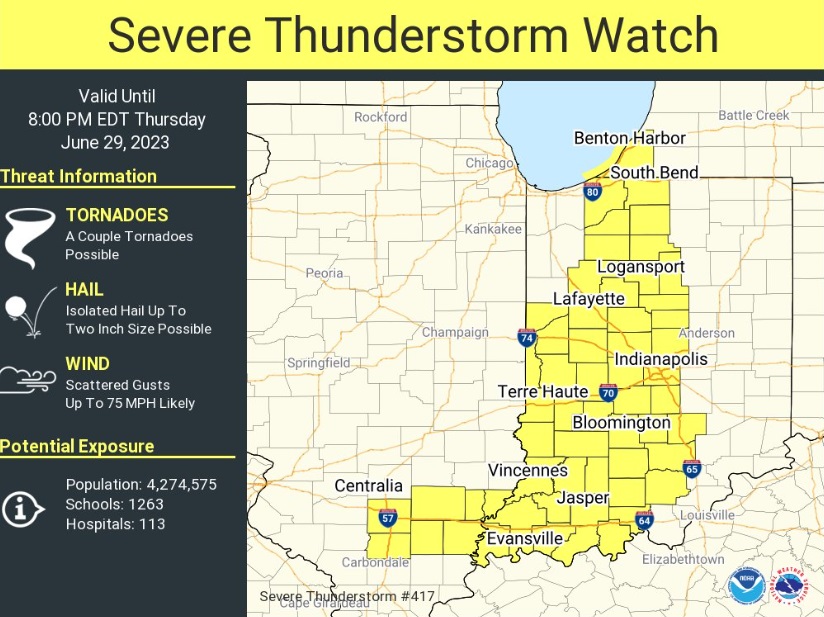
The National Weather Service has issued a Severe Thunderstorm Watch for St. Joseph, LaPorte, Marshall, Starke, Fulton and Pulaski counties, along with several other Indiana counties outside of the MNC listening area. In Michigan, Berrien County is also in the watch zone.
The greatest chance for severe weather appears to be along and south of U.S. 30, according to the National Weather Service. Wind speeds of 60 mph+ and hail are the greatest threats.
A few thunderstorms are possible later Friday and on Saturday as well. Sunday is also trending wetter but shouldn’t be a washout all day. Monday and Tuesday will be mainly dry, with temperatures moving back into the middle to upper 80s for Independence Day.
Thursday Afternoon Severe Weather Potential Update: Risk has been increased to Enhanced across far SW Portions of the area. The greatest potential for wind gusts of 70+ mph is across the Enhanced Risk area (orange). The greatest potential of severe weather still exists in the pic.twitter.com/QtjlbAyPa1
— NWS Northern Indiana (@NWSIWX) June 29, 2023
Your ABC 57 First Warning Neighborhood Weather Center Forecast:
Thursday: Partly sunny. Storms are possible at night. High 88.
Friday: Partly sunny. Storms are possible at night. High 88.
Saturday: Scattered showers/thunderstorms. High 83.
Sunday: Showers likely, with thunderstorms also possible. Mostly cloudy, with a high near 81.
Monday: A chance of showers, with thunderstorms also possible. Mostly sunny, with a high near 84.
Tuesday: A 30 percent chance of showers and thunderstorms. Mostly sunny, with a high near 88.