
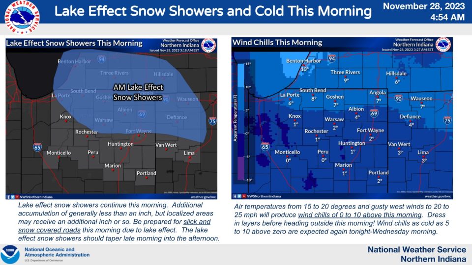
It is a cold, snowy start Tuesday. Many roads have some snow in them, so you’ll want to get out the door early and drive cautiously. Falling snow is also creating lower visibilities, especially early this morning. Lake effect snow will turn to lighter snow showers or flurries as the morning progresses. Temperatures are in the upper teens to low 20s out the door, but wind chills have dropped into the single digits. Snow will end this afternoon, but it stays cold and cloudy with highs in the upper 20s. Wednesday will offer some improvements – after a cool morning, we warm near 40 with some sun. Thursday is warmer, in the mid 40s, but there is a chance for rain starting late in the day. Rain will linger into Friday. After we dry out on Saturday, another round of rain is likely Sunday.
Tuesday: AM lake effect snow showers. Cold and breezy. High 28.
Tuesday Night: Cold and mostly cloudy. Low 18.
Wednesday: Mostly sunny. High 40.
Thursday: Becoming cloudy. PM rain. High 46.