
The coldest air of the season has entered Michiana and the first chance for snow will hit by the weekend, according to ABC 57 Chief Meteorologist Tom Coomes.
There will be a few breaks of sunshine in the forecast for Thursday, Nov. 8, but plan on more clouds than sunshine.
The next system moves in Thursday evening, bringing scattered snow and mixed showers.
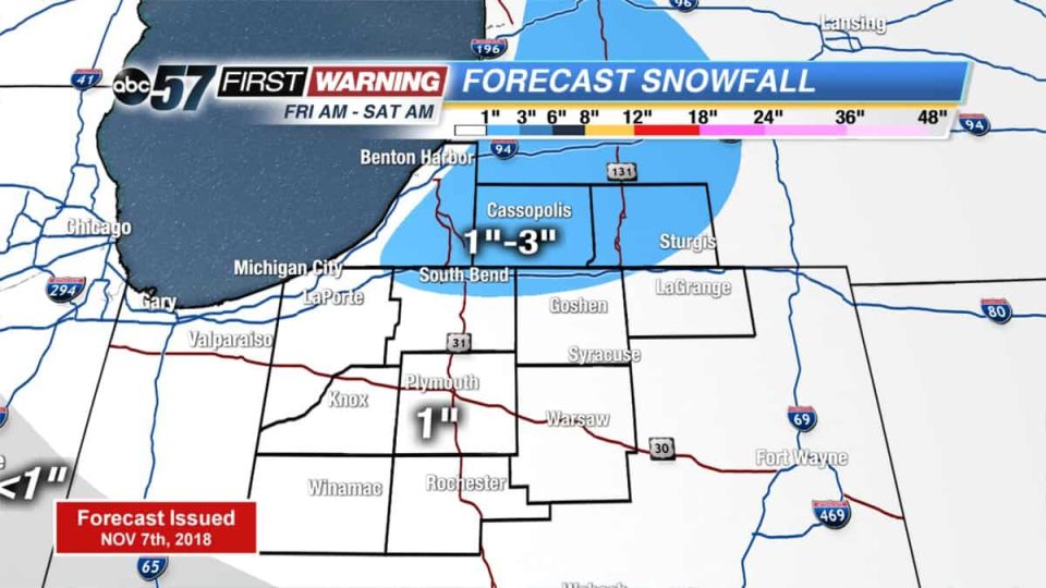
A total of 1 inch of snow is possible on grassy areas. Lake effect snow will develop as cold air dives into the area late Friday lasting through Saturday morning.
An additional 1-3” is expected in lake effect zones like Elkhart, LaGrange and St. Joseph Co. in Indiana up through the Michigan counties in the 95.3 MNC listening area.
Areas closest to the lake will see little to no accumulation because of how warm the lake is right now.
Thursday: Mostly to partly cloudy, high of 42.
Thursday Night: Scattered snow/mix, low of 32.
Friday: Mix/snow showers then lake effect snow, high of 38.
Saturday: Morning lake effect snow, high of 34.