
Temperatues climb into the mid-30s on Saturday, March 2.
Another, more substantial, round of snow will move in on Sunday, especially during the midday and afternoon hours. But, accumulations through the weekend won’t be more than an inch.
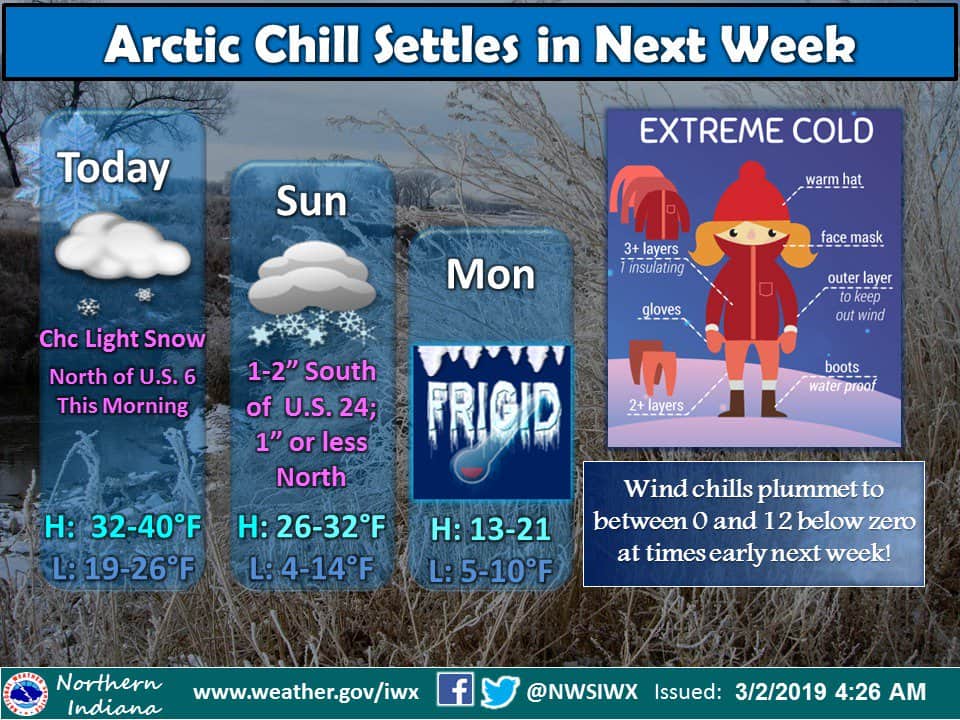
Another bitter cold shot of air drops in to start the work week, with highs only in the teens and subzero wind chills through Wednesday. Lake effect snow showers will be possible through that time, as well. Highs start to climb towards the weekend, but still stay on the cool side.
Saturday: Mostly cloudy with snow showers through lunch time. High of 34.
Saturday Night: Mostly cloudy with a slight chance of snow late. Low of 22.
Sunday: Cloudy to mostly cloudy with scattered snow showers in the midday and afternoon hours. High of 27 with temps falling throughout the afternoon.
Monday: Partly sunny and cold with a chance of lake effect snow showers. Highs in the mid-teens.