
Indiana will start the first full week of March with lake-effect snow and bitterly cold air.
The National Weather Service says an arctic air mass moved into Indiana late Sunday. In northern Indiana high temperatures will only reach the teens on Monday, March 4, with wind chills as low as minus 10. The low in South Bend on Sunday night into Monday morning was expected to drop to around 7 degrees.
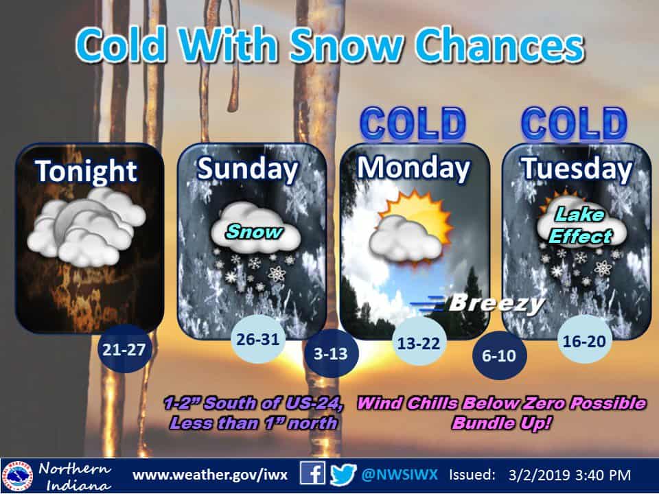
This Hazardous Weather Outlook is for northern Indiana, southwest
Michigan and northwest Ohio.

.DAY ONE...Sunday and Sunday Night.

Light snow will spread across most of the area today. The highest
snow amounts will be south of Route 24 where 1 to 2 inches are
expected.

.DAYS TWO THROUGH SEVEN...Monday through Saturday.

Wind chills will be below zero at times from Sunday Night through
Wednesday morning.
From the ABC 57 First Warning Neighborhood Weather Center:
Monday: Partly sunny and cold with a chance of lake effect snow showers. Breezy. High of 15.
Tuesday: Mostly cloudy with scattered lake effect and system snow showers. Breezy and cold. Highs in the upper teens.
Wednesday: A 40 percent chance of snow showers. Partly sunny, with a high near 24.
Thursday: Partly sunny, with a high near 29.
Friday: A 30 percent chance of snow. Mostly cloudy, with a high near 37.
Saturday: A chance of rain. Partly sunny, with a high near 41.