
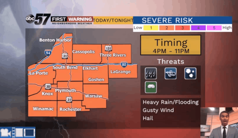
The threat for strong to severe weather continues for Monday, June 24, as a few morning showers will likely become more widespread with scattered storms in the afternoon.
Clouds may limit the overall intensity of the storms, but the risk of heavy rain, strong wind, and small hail remains.
The best chance of an isolated spin-up is well east of U.S. 31 and closer to Fort Wayne.
Tuesday begins the first dry day of many as highs will start warming into the mid-to-upper 80s by the end of the work week. Only slight chances for a pop-up shower or storm are possible Wednesday through next weekend.
Your ABC 57 First Warning Neighborhood Weather Center Forecast:
Monday: Mostly cloudy with a few AM showers, and PM showers/storms. Some could be strong. High of 78.
Monday Night: Partly cloudy with showers ending, then clearing skies. Patchy AM fog possible. Low of 62.
Tuesday: Mostly sunny. High of 81.
Wednesday: Partly sunny with a slight chance of rain, then mostly sunny. Highs in the low 80s.