
(Tyler Sebree/ABC 57 Meteorologist) Powerful winds and waves are heading for our lakeshore communities. This time, though, it could be even worse than what we’ve seen this season.
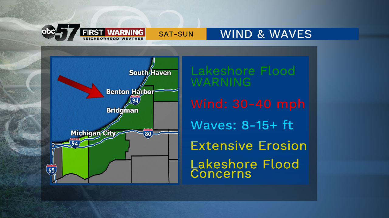 Lakeshore Flood Warning in effect for Berrien, LaPorte and Van Buren Counties Saturday late thru Sunday.
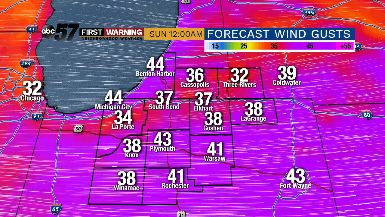 Potential peak wind gusts Saturday night.
That will send waves into the shoreline from the northwest, significantly impacting all beaches.
Those that face slightly north of west — Tiscornia Park, Lions Park, Washington Park, etc. — will see the absolute worst of the conditions.

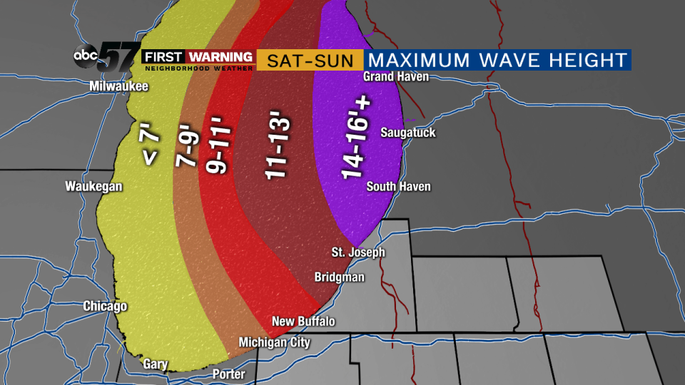
Waves will grow all day Saturday before reaching maximum heights of 10-15 feet Saturday late evening into Sunday morning.
Some waves could potentially grow to 18 feet from St. Joseph northward to Grand Haven, Michigan.
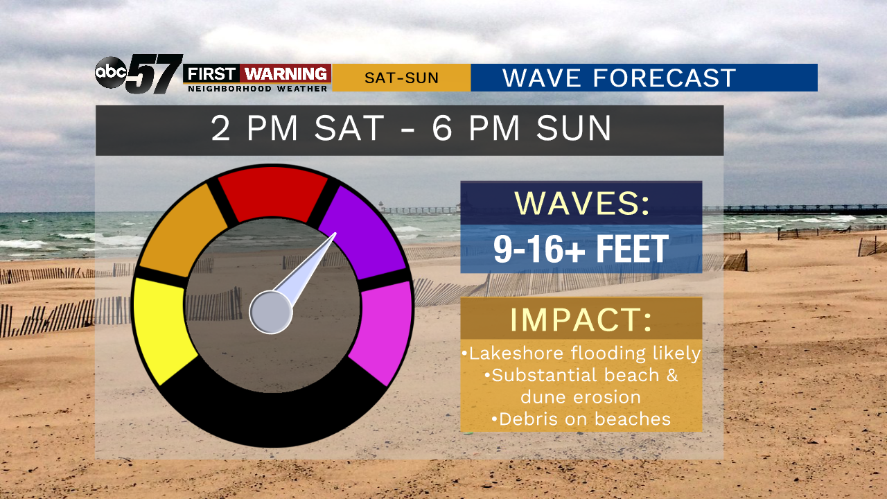
That will lead to extensive beach and dune erosion, possible structure damage to sidewalks and parks, lakeshore flooding, and deadly conditions on piers and jetties up and down the eastern side of Lake Michigan.
Wave action and winds will calm a bit late Sunday as our system pulls farther away from the region.