
(Tyler sebree/ABC 57 Meteorologist) Temperatures quickly warm into the upper 30’s around noon on Saturday, Jan. 18, which will help road conditions and change precipitation to just showers and drizzle. Significantly colder air and windy conditions move in by late Saturday. Temps will fall from the upper 30s around 12 p.m. to the upper teens by 8 p.m. This will result in a flash freeze wherever roads are wet. Winds will gust upwards of 30-40 mph Saturday afternoon thru the day Sunday.
As temperatures plummet, lake effect snow showers become possible from Saturday evening thru Sunday night. Due to the strong winds, it’ll be difficult to generate much accumulation, but an additional 1-2″ in lake effect zones can’t be ruled out. Otherwise it’s cold and quiet Monday and Tuesday.
Another system moves in next Friday and Saturday, likely bringing another round of mixed precipitation with highs in the 30s.
Your ABC 57 First Warning Neighborhood Weather Center Forecast
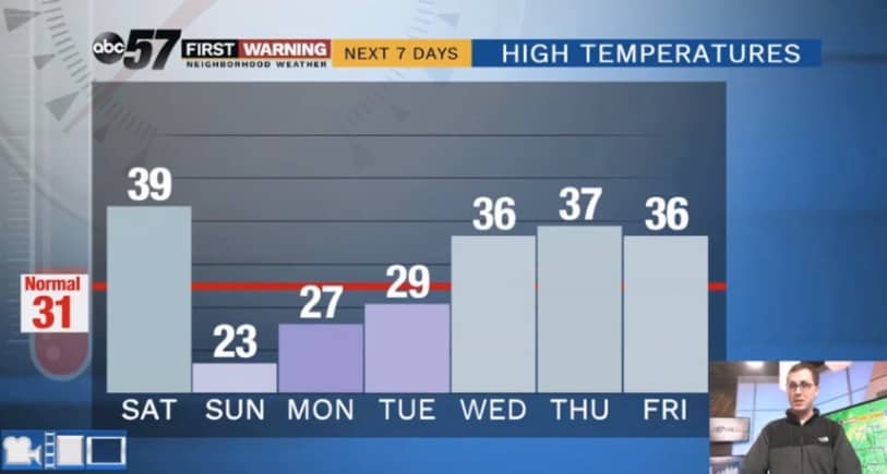
Saturday: Freezing rain to plain showers to snow showers; windy; temps drop late. High of 39.
Saturday Night: Lake effect snow showers; windy. Low of 10.
Sunday: Lake effect snow showers; breezy. High of 23.
Monday: Mostly cloudy. High of 27.