
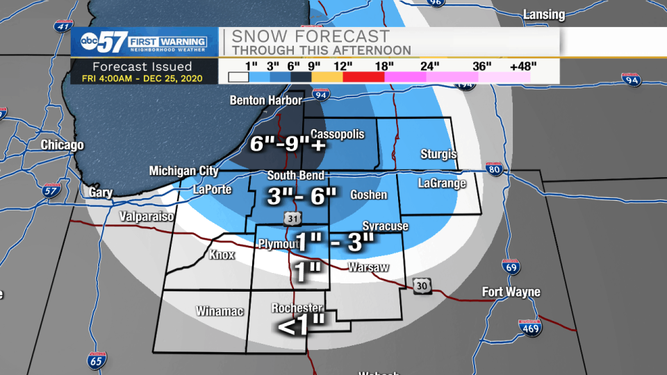
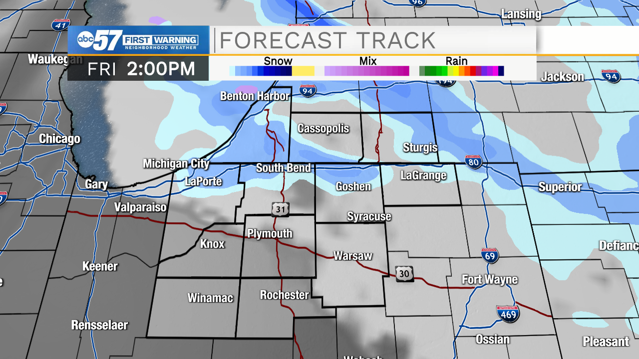
Snow showers, some heavy at times, will persist through Friday morning and into the afternoon. Temperatures this morning will be in the mid to upper teens with feel like temperatures near 0.
Later today highs will top out in the low to mid 20s. Snow showers should move out around 4 or 5pm. Snow accumulations could reach 6-9 inches in Berrien, Cass, northern LaPorte, St. Joseph, and northern Elkhart counties. Drifting snow is also a possibility as winds remain on the breezy side. Roadways will remain slick throughout the day, so travel should remain limited especially through the early afternoon.
Saturday will be dry with high temperatures topping out near freezing. Rain and snow chances return late Sunday and early Monday. There will be more chances of snow New Year’s Eve and New Years Day. Temperatures will top out in the low to mid 30s both days.
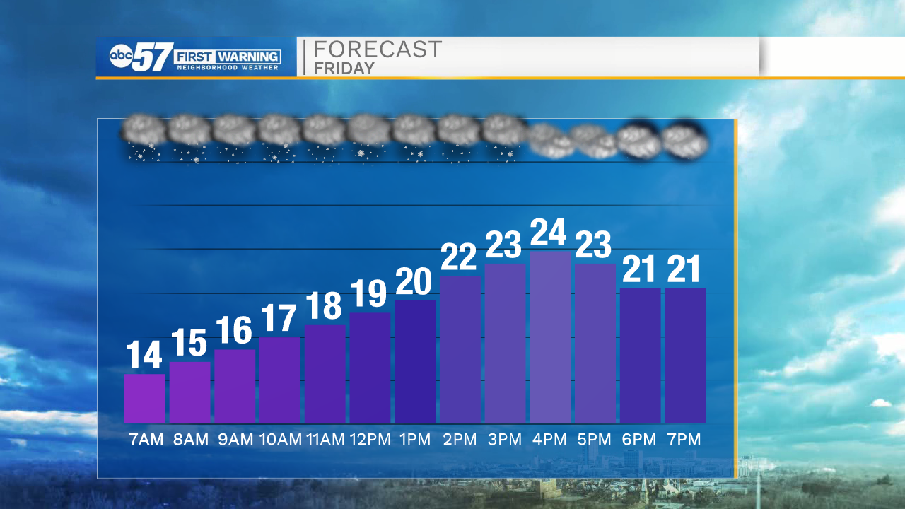
Friday: Snow showers. High 24.
Friday Night: Mostly cloudy. Low 18.
Saturday: Partly cloudy. High 32.
Sunday: Rain showers. High 42.
Including the cities of Michigan City, La Porte, South Bend,
Mishawaka, New Carlisle, and Walkerton
835 AM EST Fri Dec 25 2020 /735 AM CST Fri Dec 25 2020/

...WINTER STORM WARNING REMAINS IN EFFECT UNTIL 4 PM EST /3 PM
CST/ THIS AFTERNOON...

* WHAT...Heavy snow expected. Total snow accumulations of 3 to 10
  inches with locally higher amounts up to 15 inches in northern St
  Joseph county.

* WHERE...La Porte and St. Joseph IN Counties.

* WHEN...Until 4 PM EST /3 PM CST/ Friday.

* IMPACTS...The hazardous conditions will impact holiday
  travelers.

* ADDITIONAL DETAILS...Lake Effect snow bands will continue over
  northwest Indiana with snowfall rates up to to 1 inch per hour
  in the heavier showers this morning. Snow showers will diminish
  quickly in intensity and coverage this afternoon. Significant
  accumulations will result in snow covered roads and difficult
  driving conditions throughout today.

PRECAUTIONARY/PREPAREDNESS ACTIONS...

If you must travel, keep an extra flashlight, food, and water in
your vehicle in case of an emergency.