
(Emily Kennedy/ABC 57 Meteorologist) Snow showers persist through Tuesday morning, Jan. 26, but there’s little additional accumulation. Snow flurries are possible into the afternoon and evening. Temperatures drop for the rest of the week with daytime highs not even making it out of the 20s. Overnight lows sink to the teens, as well. We will get to see some sunshine though for Thursday and Friday. We are watching for potential lake effect snow west of US-31 Thursday morning. Saturday and Sunday look to be another round of snow / wintry mix.
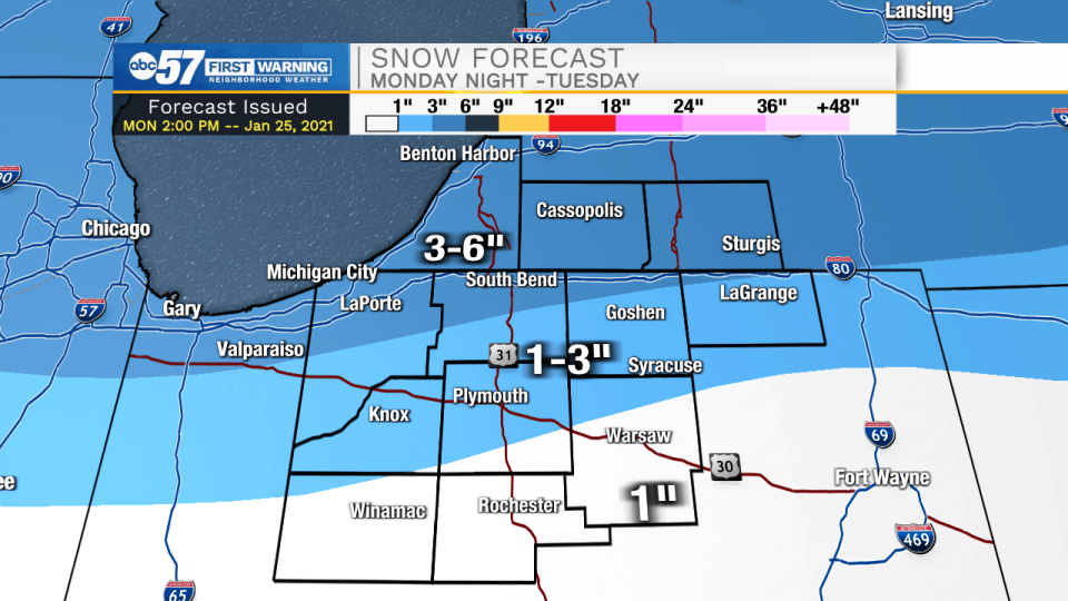
A WINTER WEATHER ADVISORY REMAINS IN EFFECT UNTIL 1 PM EST /NOON
CST/ TUESDAY...

* WHAT...Mixed precipitation. Total snow accumulations of 2 to 5
  inches across north central Indiana into southwest Lower
  Michigan to 1 to 3 inches across south central Lower Michigan
  into far northeast Indiana.

* WHERE...Portions of northern Indiana, southwest Michigan and
  northwest Ohio.

* WHEN...Until 1 PM EST /noon CST/ Tuesday.

* IMPACTS...Plan on slippery road conditions. The most hazardous
  conditions will impact the Tuesday morning commute.

* ADDITIONAL DETAILS...Snow mixed with freezing drizzle at times
  will continue the rest of the night.


PRECAUTIONARY/PREPAREDNESS ACTIONS...

Slow down and use caution while traveling.
Tuesday: Scattered snow showers. High 29.
Tuesday Night: Mostly cloudy. Low 18.
Wednesday: Mostly cloudy High 26.
Thursday: AM flurries, partly cloudy. High 27.