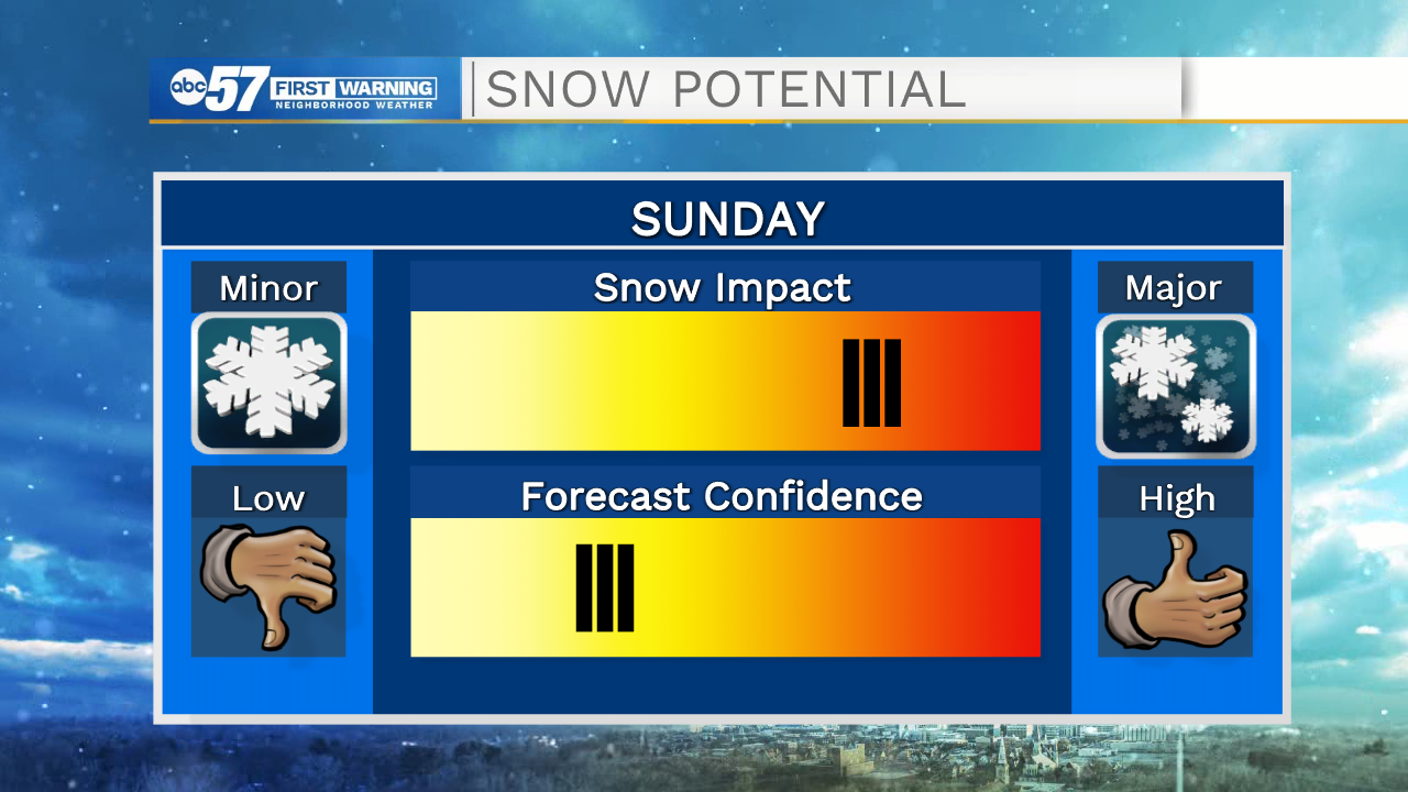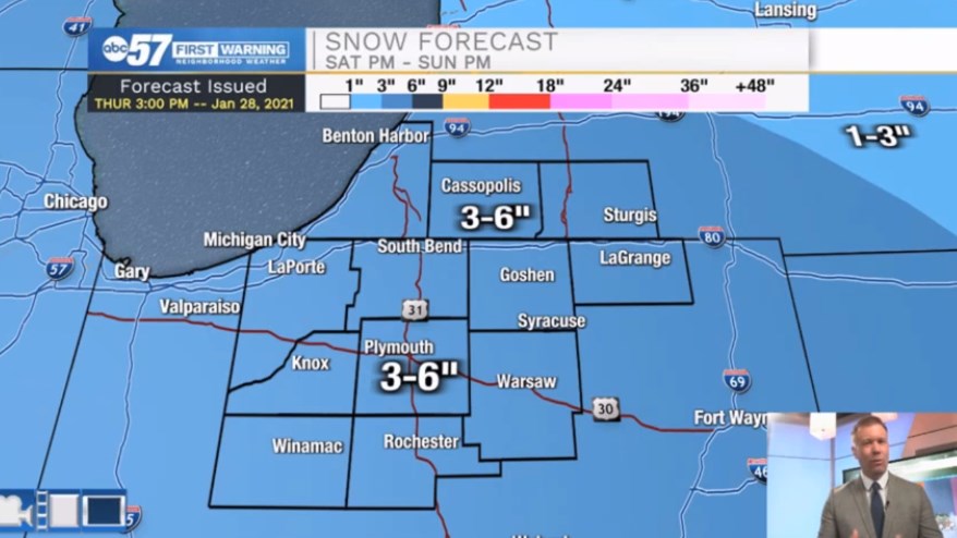
(Tom Coomes/ABC 57 Meteorologist) Cold, and quiet weather continues Friday, as highs struggle to break 30. The forecast remains fair through Saturday afternoon, a mix of sun and clouds, clouds increasing into Saturday evening. Our next winter storm starts Saturday night with heavy, wet snow into Sunday morning. Most accumulation will be from midnight to noon Sunday, then lighter snow showers / wintry mix through Sunday evening. In total up to six inches of snow is likely through Sunday evening. There will likely be additional snowfall Sunday night into Monday. We will issue a separate forecast for the second half of the storm, as there’s still some doubt on the track influencing a lake effect response into Monday morning. A moderate – high impact snow is looking more likely, but there’s still some forecast doubt three days out.
Your ABC 57 First Warning Neighborhood Weather Center Forecast
Friday: Partly cloudy. High 30.
Saturday: Mostly cloudy, snow showers late. High 32.
Sunday: Heavy snow early, then light snow / wintry mix. High 32.