
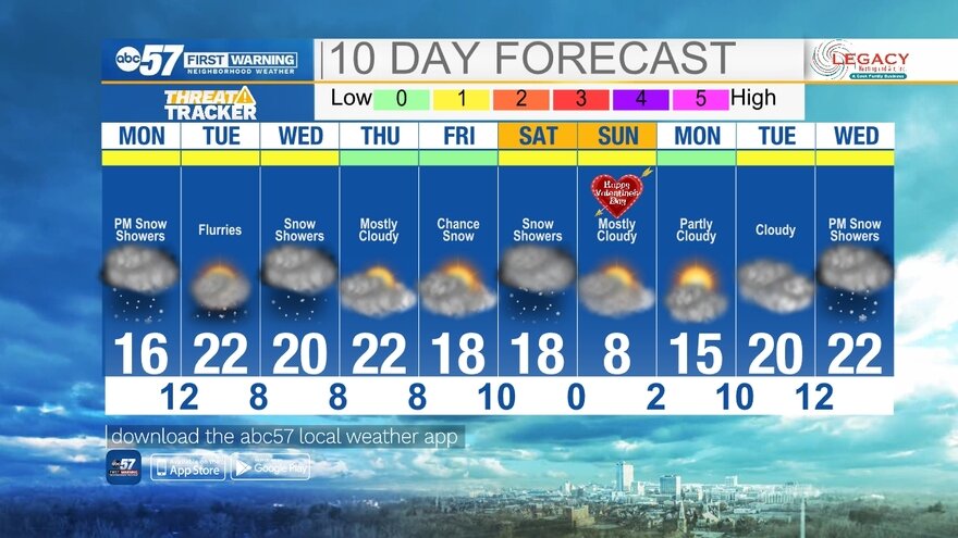
(Emily Kennedy/ABC 57 Meteorologist) It is a cold morning as we wake up to single digits with wind chill values below zero. Temperatures only top out in the mid-teens today. Light snow showers pick up after midday, becoming widespread overnight. The system moves out early Tuesday morning, leaving us with a fresh coating of 1-2″ of snow. A couple of flurries are possible during the day but no additional snowfall totals. Another quick round of light snow is possible on Wednesday but past that, the rest of the workweek is quiet with daytime highs hovering near 20 degrees.
Another cold front moves through Saturday, bringing a round of snow showers. This will drop our daytime highs into the single digits! Overnight lows may even drop below zero (and that’s without the wind chill). Temperatures bounce back into the low 20s by Tuesday next week.
Your ABC 57 First Warning Neighborhood Weather Center Forecast:
Monday: Cloudy and cold. PM snow. High 18.
Monday Night: Scattered light snow. Low 12.
Tuesday: Mostly cloudy, flurries. High 22.
Wednesday: Light snow possible. High 20.