

(Emily Kennedy/ABC 57 Meteorologist) Wednesday, July 28, is our last hot and muggy day in this stretch.
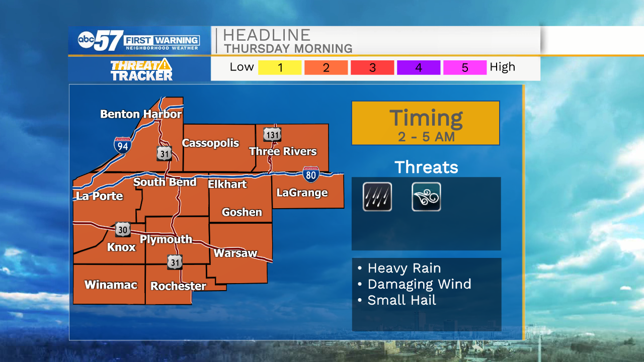
Storms will move in to Michiana between 2 a.m. – 4 a.m. on Thursday, July 29.
They could be strong or severe with greatest threats being straight-line wind and heavy rain. Non-severe scattered storms will continue into late Thursday morning as the cold front passes through. Clouds break up for Thursday evening.
Friday looks beautiful and comfortable as we only top out in the upper 70s. Despite a chance of rain Saturday night, the weekend looks nice too. A mix of sun and clouds with a high near 80.
Hazardous Weather Outlook
National Weather Service Northern Indiana
244 PM EDT Wed Jul 28 2021
This Hazardous Weather Outlook is for northern Indiana, southwest
Michigan and northwest Ohio.

.DAY ONE...This afternoon and tonight.

Thunderstorms are likely late tonight. Severe storms capable of
damaging winds and heavy rain are possible.

.DAYS TWO THROUGH SEVEN...Thursday through Tuesday.

Additional storms are possible on Thursday. There is a chance for
severe storms...mainly along and south of highway 24.
Your ABC 57 First Warning Neighborhood Weather Center Forecast:
Wednesday: Mostly sunny. High 88.
Wesnesday Night/Overnight: Scattered storms, possibly strong to severe. Low 72.
Thursday: AM showers/storms. High 82.
Friday: Partly cloudy. High 78.
Saturday: Mostly sunny with a high of 81.
Sunday: Sunny. High of 76.