
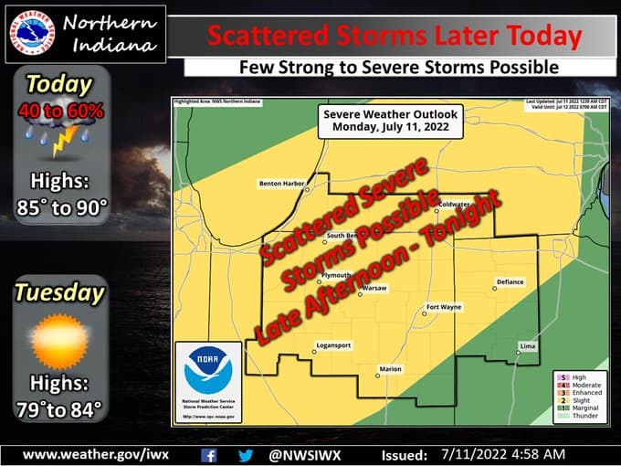
There are possibilities of severe weather later today, says the National Weather Service.
Most of northwest Indiana is under a “slight risk” of severe weather, which means that scattered severe storms are possible but typically are short-lived and not widespread.
“Our main concern this evening is going to be for damaging wind gusts that could come from thunderstorms that will develop later this afternoon. Heavy rain is a concern as well,” said Kyle Brown, meteorologist with the National Weather Service in Northern Indiana.
Brown believes the likely severe weather timeline for northern Indiana is 4 pm Monday through 1 am Tuesday. That threat is supposed to extend through 3 am Tuesday south of that area. Most of central and southern Indiana is in a “marginal risk” of severe weather. A marginal risk means isolated severe storms are possible, with the threat of isolated damaging winds, small hail, and maybe a tornado.
“There is a cluster of storms moving through Illinois and will be in Indiana soon. We’ll have to see how this cluster of storms alters the environment,” said Brown.
Most places will get high temperatures in the 90s this afternoon.
“Aside from this rain chance for today, things are looking pretty dry after that. We’re not done with the drought quite yet,” said Brown.
The latest U.S. drought monitor shows 94% of Indiana is abnormally dry while 39% of Indiana is considered to be in “moderate drought.”