
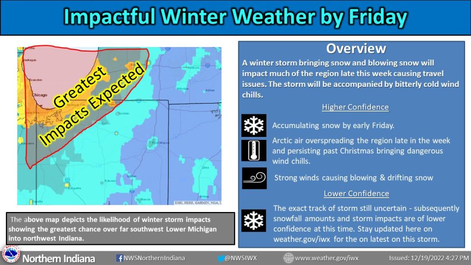
A Winter Storm Watch goes into effect for the entire listening area on Thursday evening. A wintry mix Thursday afternoon and evening will likely transition to snow Thursday night. Snow may be moderate to heavy at times through Saturday morning. Storm total snow amounts may exceed 6 inches, especially near Lake Michigan. Westerly winds could gust as high as 55 mph, and will cause blowing and drifting and blizzard-like conditions. On Saturday, we more blowing snow and lake effect snow showers likely. Any snow should wrap up early on Christmas morning. The holiday is shaping up to be very cold, with highs in the teens and lows near zero.
URGENT - WINTER WEATHER MESSAGE
National Weather Service Northern Indiana

WINTER STORM WATCH IN EFFECT FROM THURSDAY EVENING THROUGH
SATURDAY MORNING...

* WHAT...Blizzard conditions possible. A wintry mix Thursday
  afternoon and evening will likely transition to snow Thursday
  night. Snow may be moderate to heavy at times through Saturday
  morning. Storm total snow amounts may exceed 6 inches,
  especially near Lake Michigan. Westerly winds could gust as
  high as 55 mph, and will cause blowing and drifting.

* WHERE...Portions of northern Indiana, southwest Michigan and
  northwest Ohio.

* WHEN...From Thursday evening through Saturday morning.

* IMPACTS...Travel could be very difficult. Areas of blowing
  snow could significantly reduce visibility. The hazardous
  conditions could impact the morning or evening commutes. Gusty
  winds could bring down tree branches. The cold wind chills as
  low as 30 below zero could cause frostbite on exposed skin in
  as little as 30 minutes.

* ADDITIONAL DETAILS...Dangerous cold is expected Thursday night
  into Sunday. Low temperatures will be in the single digits above
  and below zero. High temperatures will be in the single digits
  and teens above zero. Wind chill values could fall to around 20
  to 30 below zero at times. The lowest wind chills will be Friday
  into Saturday. Additional snow accumulations are expected near
  Lake Michigan through Sunday in west-northwest wind favored
  snow belts.
Travel conditions will deteriorate rapidly Thurs night and Fri as the edge of a bitterly cold air mass spreads east into the forecast area and as snow with strong winds develop. Wet or slushy roads will rapidly freeze by daybreak as snow develops causing hazardous travel. pic.twitter.com/TOwiSNhHYS
— NWS Northern Indiana (@NWSIWX) December 19, 2022
Your ABC 57 First Warning Neighborhood Weather Center Forecast:
Tuesday: A mixture of clouds and sun. High 35.
Wednesday: Cloudy. High 32.
Thursday: Wintry mix. High 36.
Friday: Snow. Widespread blowing snow. High near 19.
Saturday: Chance for continued snow showers. Mostly cloudy and cold, with a high near 14.
Christmas Day: Partly sunny and cold, with a high near 14.