
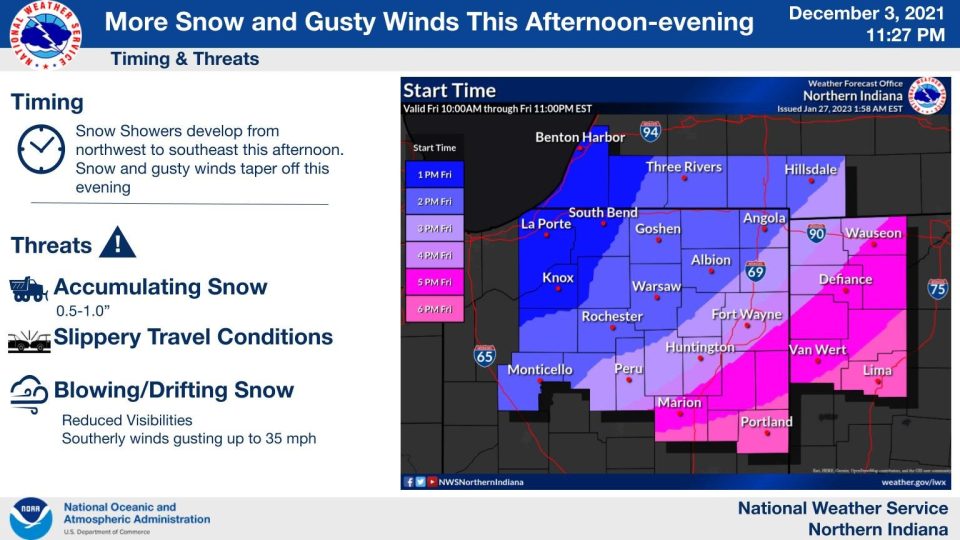
Lake effect snow is coming to an end early this Friday morning. Roads will be snowy and possibly slick in some areas for your commute. Temperatures in the teens this morning climb into the lower 30s by afternoon. The wind picks up for the second half of the day, with a few wind gusts 30-35 mph possible. Another round of snow is likely later this afternoon into the evening. We will likely pick up less than 1″ of snow today. It’s a quiet start Saturday, but precipitation returns Saturday evening. It’s mainly snow, but it could be a slushy snow. Snow showers continue into Sunday morning. We could see an additional 1-2″ of snow by Sunday morning. Temperatures are cooler next week with highs in the 20s then teens.
Your ABC 57 First Warning Neighborhood Weather Center Forecast:
Friday: Breezy. Afternoon/evening snow showers. High 34.
Saturday: Mostly cloudy. PM snow. High 30.
Sunday: Morning snow showers. High 28.
Monday: Cloudy, with a high near 22.
Monday Night: Mostly cloudy, with a low around 8.
Tuesday: A slight chance of snow showers in the afternoon. Otherwise, mostly cloudy and cold, with a high near 17.