
There are two big weather impacts on Wednesday, July 26: heat and thunderstorms.
There is a heat advisory from 8 a.m. Wednesday through midnight Friday for all of Michiana. Temperatures climb into the lower 90s today, but with humidity, we feel like we are in the mid/upper 90s. Remember to hydrate before you go outdoors. If you are out and about, you may notice it looks a little hazy once again. Wildfire smoke is starting to clear out of the area, but air quality is starting in the red “unhealthy” category this morning.
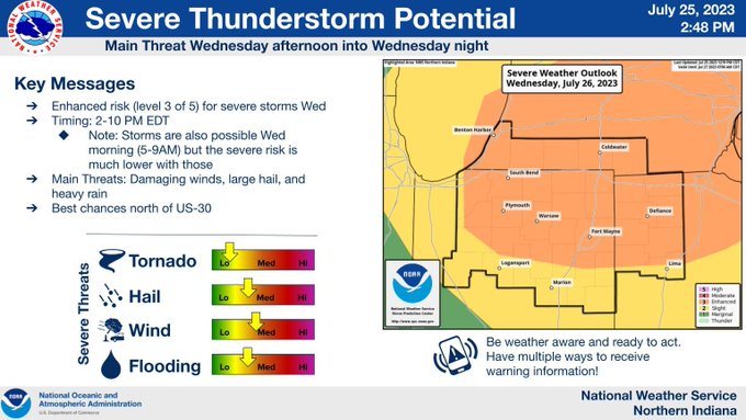
The morning is dry. A round of rain and storms is likely midday, but should not reach the severe threshold. Storms will redevelop this evening, which will be the more impactful round (strong, possibly severe storms). Potential impacts include: gusty winds, large hail, heavy rain, flooding, and possibly a tornado. Storms move out of the area late tonight.
Thursday we shouldn’t see any rain or storms, but the day is even hotter with highs in the mid 90s and heat indices near 100 degrees. Friday once again we face extreme heat. A round of storms is likely Friday evening. Showers continue into Saturday, then temperatures begin to regulate. We’re in the mid 80s Saturday and low 80s Sunday.
Your ABC 57 First Warning Neighborhood Weather Center Forecast:
Wednesay: Hot. PM Storms. High 91.
Wednesday Night: Showers/storms early. Low 70.
Thursday: Sweltering, sunny. High 94.
Friday: Sweltering, Evening storms. High 95.