

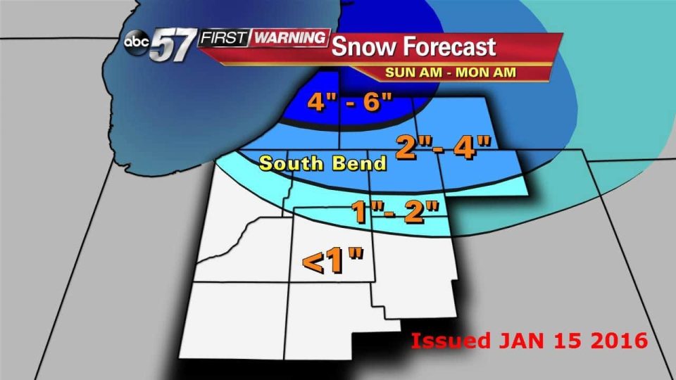
The National Weather Service in Northern Indiana has issued a Winter Weather Advisory which is in effect from 4 a.m. Sunday to 10 a.m. Monday.
Lake effect snow will develop early Sunday morning and persist through Monday morning. The heaviest snow showers with reduced visibility will likely occur Sunday into Sunday evening.
Total snow accumulations of 3 to 6 inches is possible. Some blowing snow will be possible as west winds increase to 15 to 20 mph with gusts near 25 mph.
Roads will become snow-covered, slick and hazardous. Reduced visibility is possible due to falling and blowing snow.
Wind chills are forecast to drop to between 5 and 15 degrees below zero late Sunday afternoon through Monday morning.
The ABC 57 First Warning Neighborhood Weather Center Forecast:
- Overnight Sunday morning: Wind chill below zero overnight. Chance for snow early Sunday.
- Sunday: Bitter cold and lake effect snow, highs in the mid teens.
- Monday: Bitter cold and light snow, highs in the lower teens.
- Tuesday: Partly cloudy, highs in the upper teens.
- Wednesday: Snow showers, highs in the mid 20s.
