

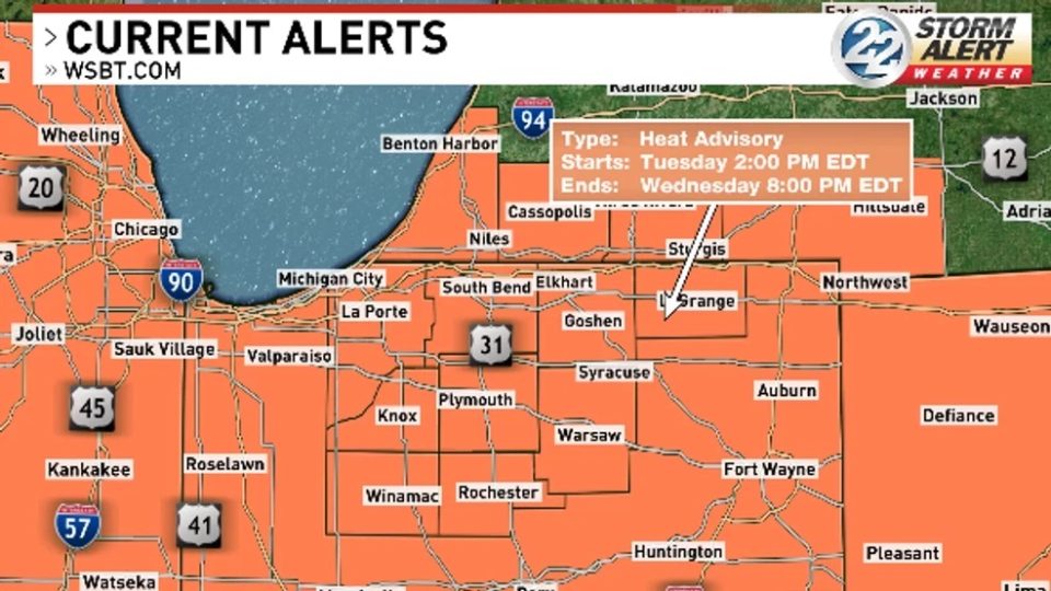
Dangerous heat settles into our area this week after a long break from summertime weather.
All of Michiana will be under a Heat Advisory from 2 p.m. Tuesday until 8 p.m. Wednesday.
Heat and humidity have been gradually building over the last few days, and this week they reach their peak.
Most of Tuesday will be dry with sun and clouds mixed. Highs will reach to near 90, however dew points will be well into the 70s.
This will make us feel like the upper 90s or closer to 100 this afternoon.

Some isolated showers and storms are possible this afternoon as well, fueled by the heat and humidity.
The Storm Prediction Center has placed part of our area under a Level 1 risk for severe weather for Tuesday.

Any stronger storms that form have the potential to contain damaging winds, however not everyone will see rain.
The dangerous heat sticks around through at least Wednesday, as highs climb into the low 90s.
Humidity will remain very high Wednesday as well, making it another day where heat index values could push into the triple digits.
Make sure to stay as cool and hydrated as possible the next few days! Heat related illnesses can settle in easily during hot days like what we will see this week.
Temperatures hold onto the mid to upper 80s through the rest of the workweek, with dew points remaining elevated.
Most days this week will feature chances for off and on showers and storms, though there still will be plenty of dry time.
Some relief from the heat and humidity does not look like it will arrive until possibly the end of the weekend.
