
Rain moved into Michiana on Sunday night and turned to snow in most areas during the overnight hours.
The morning commute is expected to be heavily impacted, as some of the most intense snow is expected from around 6-8 a.m. Lake effect snow bands will develop after system snowfall moves out, lasting through Monday, as well as Tuesday and Tuesday night.
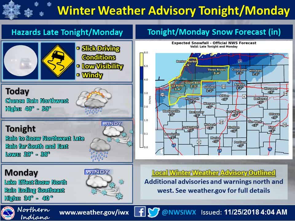
The system snowfall accumulation will vary widely across Michiana. Less than 1″ is expected for the southern counties, and totals will be higher the further north you go. 4-6″ will be the highest amount, possible for northern Berrien County.
A Winter Weather Advisory is in effect until 1 p.m. for Berrien, Cass, St. Joseph (MI), LaPorte and St. Joseph (IN) counties. The Advisory zone will have slick conditions due to 2+ inches of snow, windy conditions and low visibility. Winds will pick up as the system moves through, gusting around 30 mph on Monday, and around 40-50 mph near Lake Michigan.
Coastal flooding is possible due to the strong winds creating huge waves.
Your ABC 57 First Warning Neighborhood Weather Center Forecast for Michiana:
Monday: AM snow, and a very slick AM commute. Scattered lake effect snow showers, windy, high of 33.
Tuesday: Mostly cloudy with a slight chance for lake effect snow in Michigan, but more lake effect possible at night with accumulations less than 2″. Highs in the mid 20s.
Wednesday: Partly to mostly cloudy, highs in the upper 20s.