
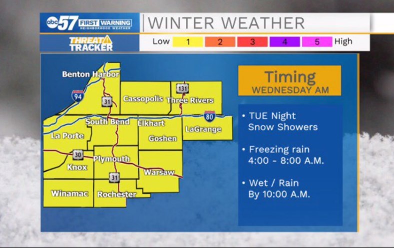
Snow showers on Tuesday night brought a quick inch or so of snow, but rain began after midnight, causing a concern for ice, or freezing rain, during the early morning hours of Wednesday.
Temperatures rise above freezing quickly through Wednesday morning, according to ABC 57 Meteorologist Tom Coomes.
Wednesday will be wet and any ice concerns melt quickly as temperatures spike into the low 40s by noon. Temperatures fall through the afternoon and rain could mix with a little snow, before ending.
Thursday is a cold and quiet day before another mess to ring in the New Year. New Year’s Eve should be uneventful but the early morning on Friday has the potential for more freezing rain, a greater impact than Wednesday. The good news is the weekend forecast is quiet again.
La Porte-St. Joseph IN-Berrien-Cass MI-
Including the cities of Michigan City, La Porte, South Bend,
Mishawaka, New Carlisle, Walkerton, Niles, Benton Harbor,
St. Joseph, Fair Plain, Benton Heights, Buchanan, Paw Paw Lake,
Dowagiac, Cassopolis, and Marcellus
232 PM EST Tue Dec 29 2020 /132 PM CST Tue Dec 29 2020/

...WINTER WEATHER ADVISORY REMAINS IN EFFECT FROM 7 PM EST /6 PM
CST/ THIS EVENING TO 7 AM EST /6 AM CST/ WEDNESDAY...

* WHAT...Mixed precipitation expected. Total snow accumulations of
  a half inch to 2 inches and ice accumulations of up to one
  tenth of an inch.

* WHERE...In Indiana, La Porte and St. Joseph IN Counties. In
  Michigan, Berrien and Cass MI Counties.

* WHEN...From 7 PM EST /6 PM CST/ this evening to 7 AM EST /6 AM
  CST/ Wednesday.

* IMPACTS...Plan on slippery road conditions. The hazardous
  conditions could impact the morning commute.

* ADDITIONAL DETAILS...A period of snow is expected this evening,
  mainly between 7 pm and 11 pm EST. This will change over to
  freezing rain after midnight, and then eventually over to all
  rain between 6 am and 9 am EST Wednesday morning.

PRECAUTIONARY/PREPAREDNESS ACTIONS...

Slow down and use caution while traveling.
Your ABC 57 First Warning Neighborhood Weather Center Forecast:
Wednesday: Early AM Freezing rain. Rainy through the day. Windy. High 44.
Thursday: Mostly cloudy. Overnight wintry precipitation. High 35.
New Year’s Day: Snow and freezing rain, possibly mixed with sleet and freezing rain, then just rain after 11 a.m. High near 43.
Saturday: Mostly cloudy, with a high near 37.
Sunday: Partly sunny, with a high near 37.