
(Maci Tetrick/ABC 57 Meteorologist) It was another hot and humid day on Sunday, June 20, with the chance for strong to severe storms. The National Weather Service of Northern Indiana issued a Severe Thunderstorm Watch until 1 a.m. EDT on Monday.
Strong to severe storms began to dot the region by 6 p.m. on Sunday.
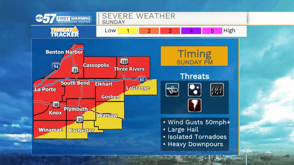
The biggest threats for storms is damaging gusty winds. We also could see hail and periods of heavy rain. The possibility of a tornado can’t be ruled out.
Thunderstorms continue through early Monday morning. Out the door tomorrow, you’ll likely still need an umbrella with showers expected through early afternoon, but no more thunderstorms.
Temperatures are cooler Monday and Tuesday in the low 70s before a warming trend starts Wednesday.
VIEW INDIANA MICHIGAN POWER OUTAGE MAP
Your ABC 57 First Warning Neighborhood Weather Center Forecast:
Sunday: Mix of sun and clouds. Thunderstorms (possibly strong or severe) in the afternoon and evening. High 90.
Sunday Night: Thunderstorms (possibly strong or severe). Low 66.
Monday: Scattered showers. Breezy. High 74.
Tuesday: Mostly sunny. High 70.