
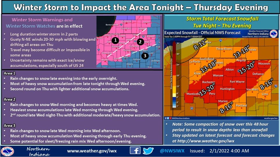
A Winter Storm Warning is in effect for the entire 95.3 MNC listening area from 1 a.m. on Wednesday, Feb. 2 through 7 p.m. on Thursday, Feb. 3.
Rain showers start in the afternoon, and become more numerous/widespread by tonight. As temperatures drop, rain will turn to snow. The snow will continue through Wednesday and Thursday. Considering this winter storm in three parts is helpful, as it is a long duration event.
Part one: Tuesday overnight / early Wednesday morning. Rain showers gradually turn to snow. Before this happens, roads could become slick / icy before snow starts to accumulate.
Part two: Wednesday. Snow continues throughout the entire day. Periods of heavy snow are possible. Michiana will likely have snow totals in the 6-10” range for the day.
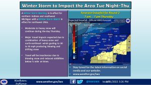
Part three: Thursday. Additional snow accumulations Thursday. Wind gusts up to 35 mph will mean blowing / drifting snow and periods of low visibility. Snow tapers off later in the day.
Snow, in excess of 12 inches, is expected to fall, in total, for most areas, through late Thursday.
After Thursday, the rest of the week and weekend is quiet, but cold temperatures return with sub-zero wind chills return. Temps will improve beginning on Sunday and carrying into next week.
WINTER STORM WARNING IN EFFECT FROM 1 AM EST /MIDNIGHT CST/
WEDNESDAY TO 7 PM EST /6 PM CST/ THURSDAY...

* WHAT...Heavy snow and dangerous travel expected. Total snow
  accumulations in excess of 10 inches.

* WHERE...Portions of northern Indiana and southwest Michigan.

* WHEN...From 1 AM EST /midnight CST/ Wednesday to 7 PM EST /6
  PM CST/ Thursday.

* IMPACTS...Travel will become very difficult to impossible.
  Blowing snow could significantly reduce visibility. The
  hazardous conditions will affect midweek commutes.

* ADDITIONAL DETAILS...Rain will change to snow from northwest to
  southeast early Wednesday morning. This will be a long duration
  snow event, with periods of moderate to heavy snow and reduced
  visibilities.

PRECAUTIONARY/PREPAREDNESS ACTIONS...

If you must travel, keep an extra flashlight, food, and water in
your vehicle in case of an emergency.
We’d like to implore you to stay home starting in the early hours Wed morning through Thurs evening if you can. This weather event is going to be extremely impactful throughout the whole district (and state), and emergency services will likely be stretched thin. #INDOTWinterOps pic.twitter.com/60tYdLbGco
— INDOT Northwest (@INDOTNorthwest) February 1, 2022
Your ABC 57 First Warning Neighborhood Weather Center Forecast:
Tuesday: Increasing clouds. Breezy. Rain by evening. High 42.
Wednesday: Snow. High 30.
Wednesday Night: Snow likely. Cloudy, with a low around 16.
Thursday: Another chance for snow. Mostly cloudy and cold, with a high near 20.
Thursday Night: A with a low around 2.
Friday: Partly sunny and cold, with a high near 17.
Friday Night: Partly cloudy, with a low around 0.
Saturday: Mostly sunny and cold, with a high near 20.