
(Tom Coomes/ABC 57 Meteorologist) A Winter Storm Warning is in effect for St. Joseph, LaPorte, Berrien and Cass Counties until 10 a.m. on Thursday, Nov. 17.
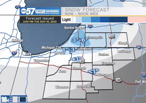
The pattern is active, cold and snow weather through the end of this week. The snow impacts vary with the lake effect snow, which ramps up-and-down as temperatures fall overnight and rise into the afternoon. The first bullseye is Berrien county early Wednesday with the potential for more than three inches of snow. Then temps rise just above freezing Wednesday afternoon, followed by the heaviest lake effect snow Wednesday night into Thursday, with upwards of six inches of snow possible, in the snow belt. Temperatures are much colder to end the week, and lake effect snow will persist into Friday.
National Weather Service Northern Indiana

WINTER STORM WARNING REMAINS IN EFFECT FROM 4 AM EST /3 AM
CST/ WEDNESDAY TO 10 AM EST /9 AM CST/ THURSDAY...

* WHAT...Heavy, wet lake effect snow. Total snow accumulations
  of 5 to 10 inches. Locally higher amounts around 1 foot
  possible near the Indiana, Michigan stateline in northern La
  Porte and southern Berrien counties.

* WHERE...Portions of northern Indiana and southwest Michigan.

* WHEN...From late tonight through Thursday morning.

* IMPACTS...Travel is expected to become very difficult Wednesday
  morning and continue into Thursday morning. The hazardous
  conditions will impact the morning and evening commutes.
Your ABC 57 First Warning Neighborhood Weather Center Forecast:
Wednesday: Snow / Mix. High 36.
Thursday: Snow showers. High 32.
Friday: Light snow. High 28