
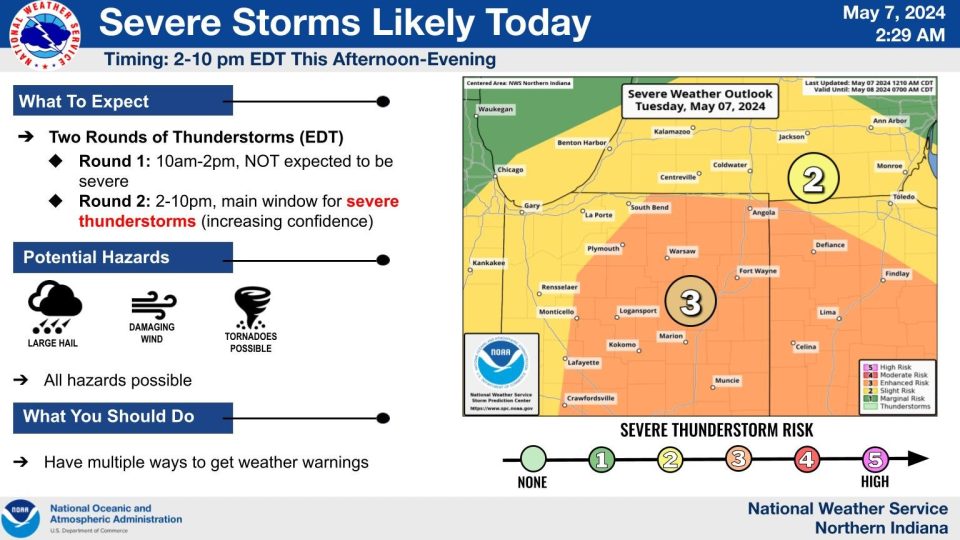
Tuesday is expected to be an active weather day with scattered showers and storms beginning around mid-morning.
Then, there’s a short lull with more storms Tuesday afternoon.
The greatest concern for severe weather will be Tuesday afternoon, 2 p.m. to 10 p.m., with the greatest risk from 4 p.m. to 8 p.m. as scattered strong storms develop ahead of the cold front.
There is plenty of forcing and lift from the fronts moving through and spin in the atmosphere. However, storm energy may be lacking as highs struggle to reach the mid-70s.
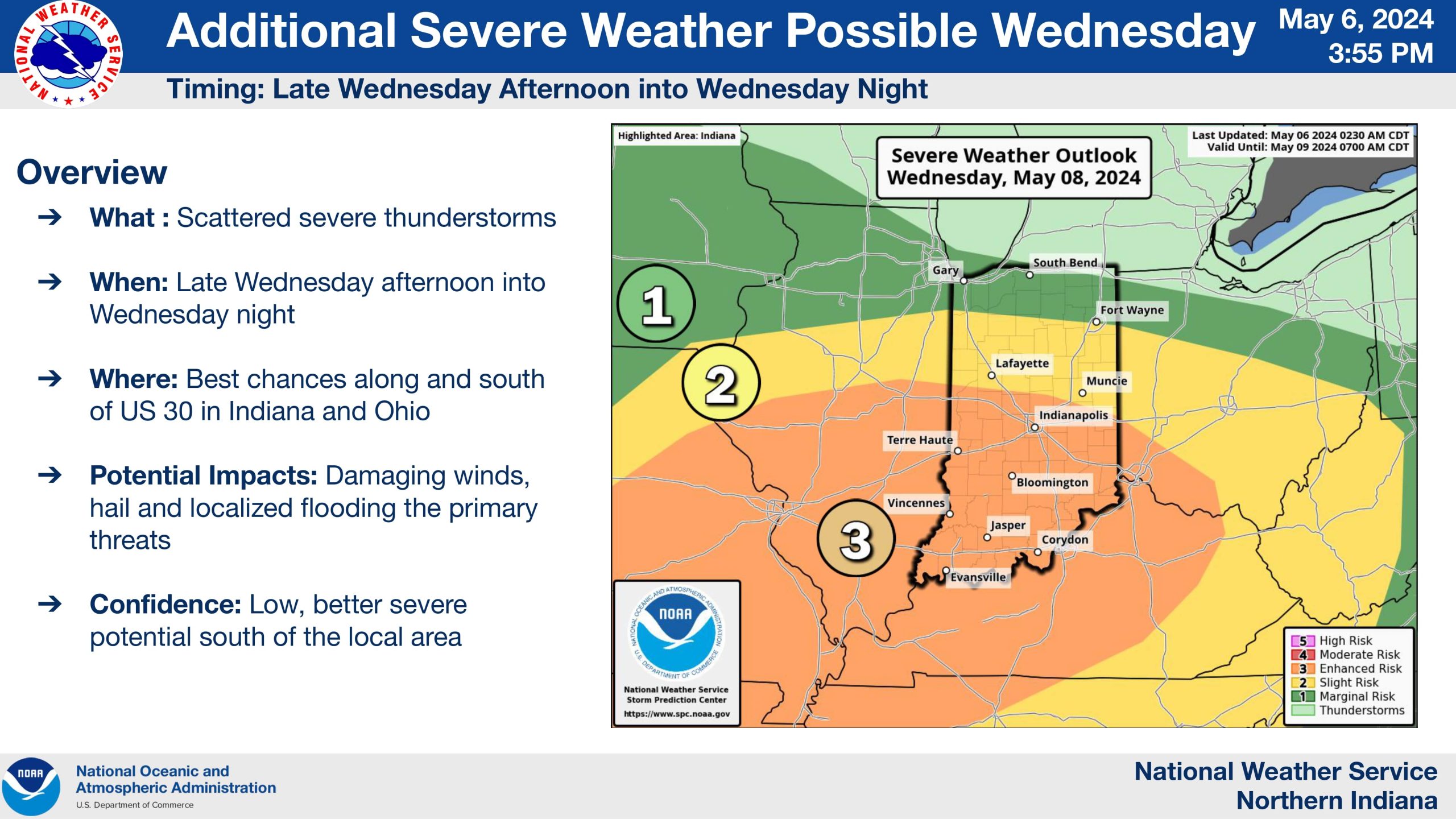
The storm clear Tuesday evening, and the forecast is fair through Wednesday afternoon, highs make a run at 80 degrees. There will be more showers Wednesday night through Thursday but the severe threat looks much lower.
The National Weather Service says the best threat Tuesday will be during the afternoon and evening hours.
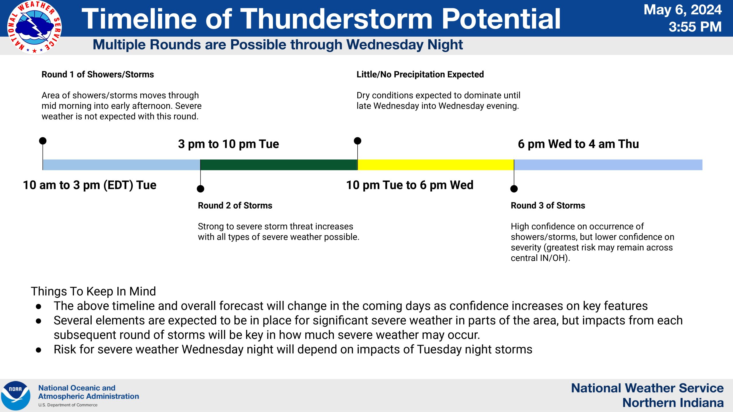
Wednesday’s forecast still remains somewhat unclear, but the most likely period for severe storms should be in the later evening.
Damaging winds, hail, and tornadoes are all possible.
Tuesday: AM/PM Thunderstorms. High 74.
Wednesday: Evening T-showers. High 80.
Thursday: Showers. High 60.
Here is a brief video on details regarding today’s severe weather potential … https://t.co/ufPFijRObV
— NWS Northern Indiana (@NWSIWX) May 7, 2024