
(WSBT Storm Alert Team) On Thursday, April 2, we see storms in the morning but then skies will be mostly cloudy.
Highs on Thursday afternoon will be near 73. It will be windy, as well. A Wind Advisory is in effect for the entire listening area from 11 a.m. until 8 p.m. EDT. Gusts could top 45 m.p.h. at times.
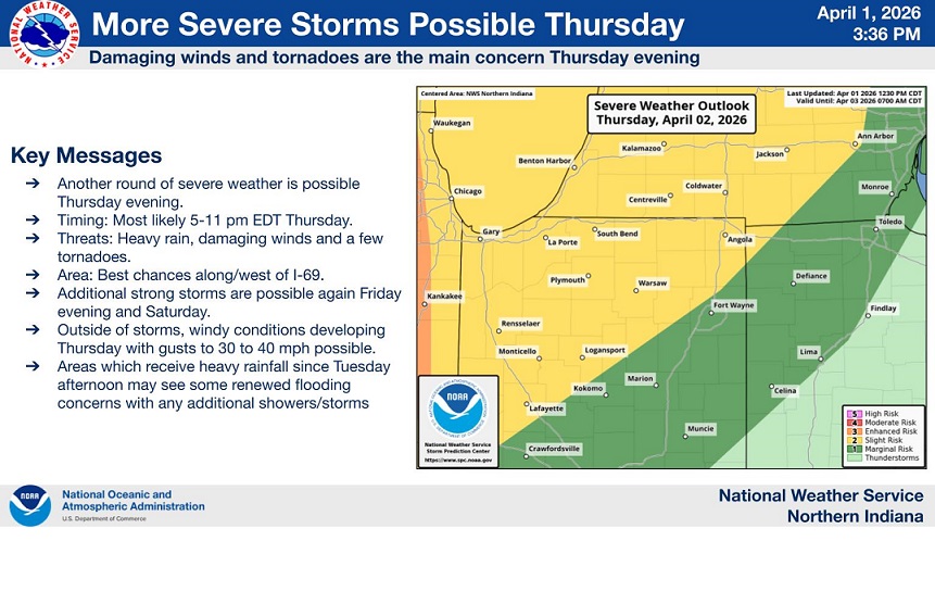
Our next chance of strong-to-severe storms will develop Thursday afternoon and evening. Damaging winds, an isolated tornado, and large hail will be the threats in these storms.
Chances of off and on rain and storms are possible on Friday and Saturday with highs in the 60s.
Easter Sunday looks cold this year. Early morning temperatures will be in the middle to upper 30s. Daytime highs will be in the low to middle 40s. Rain should move out very early Sunday morning, most of the day looks dry at this point.
WIND ADVISORY IN EFFECT FROM 11 AM EDT /10 AM CDT/ THIS MORNING
TO 8 PM EDT /7 PM CDT/ THIS EVENING...

* WHAT...South winds 15 to 25 mph with gusts up to 45 mph expected.

* WHERE...Portions of northern Indiana and southwest Michigan.

* WHEN...From 11 AM EDT /10 AM CDT/ this morning to 8 PM EDT /7 PM
  CDT/ this evening.

* IMPACTS...Gusty winds will blow around unsecured objects. Tree
  limbs could be blown down and a few power outages may result.

PRECAUTIONARY/PREPAREDNESS ACTIONS...

Secure outdoor objects.
Showers and isolated storms tonight into early Thursday, then more scattered showers/storm late Thursday afternoon/evening. There is a Slight Risk of severe storms late Thursday with potential main threats of damaging wind gusts and isolated tornadoes. pic.twitter.com/9bFVaQGNgu
— NWS Northern Indiana (@NWSIWX) April 1, 2026