
(WSBT Storm Alert Team) After a break from active weather, strong to severe storms return to Michiana.
Our whole area will be under a Level 2 risk for severe weather Tuesday.

The best chance for severe weather will arrive late in the day Tuesday as a cold front approaches.
Chances for rain will start to go up Tuesday afternoon ahead of the front, but the front itself will pass through in the evening. This is when our risk for severe weather will increase.
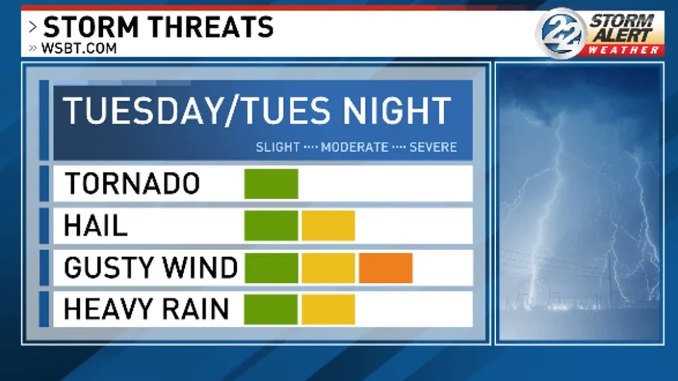
The main risk for Tuesday’s storms are gusty winds and hail, however an isolated tornado cannot be ruled out.

Make sure to have multiple ways to receive severe weather alerts. The Storm Alert Weather app is a great tool to have on hand when storms are on the way. The app is free to download on the AppStore and Google Play.
Behind this front, temperatures go crashing down Wednesday.

Highs Wednesday will be reached early in the day, with most of the day being spent in the 40s.

Rain chances will also linger through the rest of the week. Expect daily off and on showers through the weekend.