
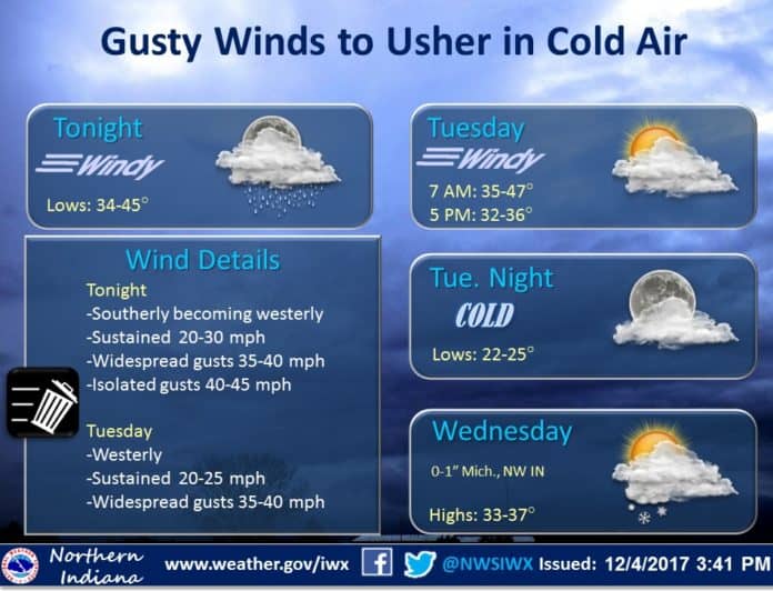
South winds continued to strengthen in Michiana in advance of a cold front.
The National Weather Service in Northern Indiana has issued a
Wind Advisory...which is in effect until 6 PM EST Tuesday.
Sustained south winds of 25 to 30 mph and gusts to around 40 mph were forecast into the early morning hours of Tuesday, Dec. 5, according to the National Weather Service of Northern Indiana.
In addition, a line of showers and isolated thunderstorms was to track from west to east across the area overnight with the cold front. These showers may allow some of the stronger winds aloft to mix to the surface with a few gusts to 45 mph possible overnight.
Winter will begin Tuesday as temperatures tank. LIVE ?? https://t.co/8Q5IrS067C pic.twitter.com/6T7jxsDRw9
— Tom Coomes (@TomCoomes) December 5, 2017
Windy conditions will continue into the daylight hours of Tuesday, with gusts to top out in the 30 to 35 mph range, the National Weather Service reported.
Travel may become difficult at times due to the strong winds, especially for high profile vehicles. Unsecured outdoor objects will be blown around tonight, so take time to secure any loose lighter weight items.
Lake effect snow is expected Wednesday through Thursday and is possible again this weekend. Snow accumulations of 1 to 2 inches are possible.