
The big weather story for the next 24 hours is the sub zero temperatures and wind chill.
Lake effect snow will make its way east on Sunday afternoon, Jan. 20, dropping as much as 3 inches or more in western LaPorte County.
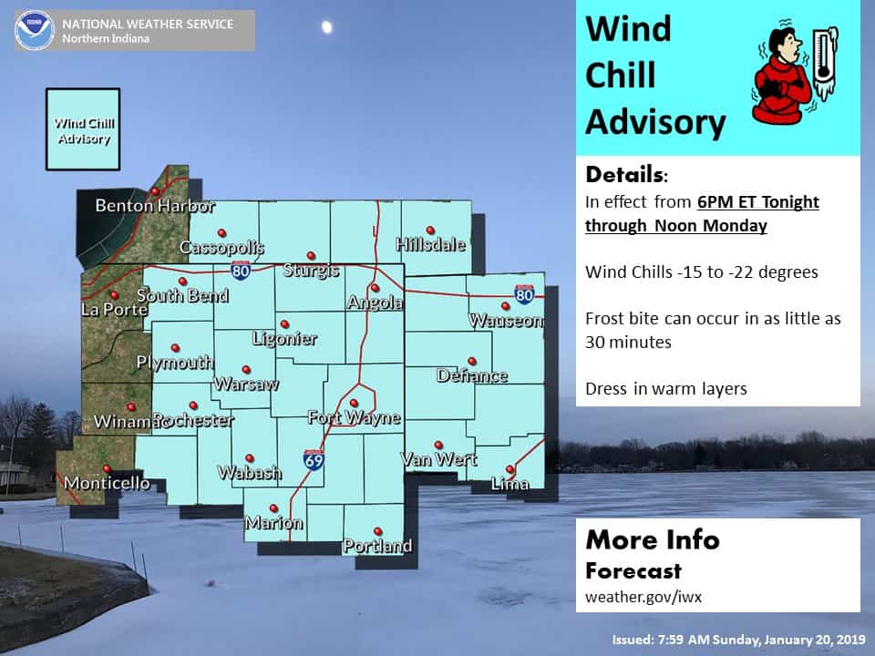
By tonight, the lake-effect bands will move back to west and skies will clear once again. A Wind Chill Advisory is in effect until 12 p.m. EST on Monday, Jan. 21, with wind chills as low as 15 below to 25 below zero expected Sunday evening through Monday morning.
Temperatures stay cold and the weather pattern remains active throughout the rest of the forecast.
WIND CHILL ADVISORY IN EFFECT FROM 6 PM THIS EVENING TO NOON
EST MONDAY...

* WHAT...Very cold wind chills expected. Wind chills as low as 15
  below to 25 below zero expected this evening through Monday
  morning. Bitterly cold conditions can also be expected today.
  Wind chills of 5 below to 15 below zero this morning will only
  moderate to zero to 10 below zero this afternoon.

* WHERE...Portions of northern Indiana, southwest Michigan and
  northwest Ohio.

* WHEN...From 6 PM this evening to noon EST Monday.

* ADDITIONAL DETAILS...The cold wind chills could cause
  frostbite on exposed skin in as little as 30 minutes.

PRECAUTIONARY/PREPAREDNESS ACTIONS...

A Wind Chill Advisory means that cold air and the wind will
combine to create low wind chills. Frostbite and hypothermia can
occur if precautions are not taken. Make sure you wear a hat and
gloves.
Your ABC 57 First Warning Neighborhood Weather Center Forecast:
Sunday: Mostly sunny to mostly cloudy with scattered L.E. snow to the west. High of 13.
Sunday Night: Mostly cloudy with L.E. snow ending, then mostly clear late. Cold with a low of -4.
Monday: Mostly sunny. High of 12.
Tuesday: Mostly cloudy with a PM wintry mix likely. Breezy. Highs climbing through the day, into the mid-30s close to midnight.