
The National Weather Service of Northern Indiana has issued a High Wind Warning, in effect from 7 a.m. on Sunday – 1 a.m. on Monday.
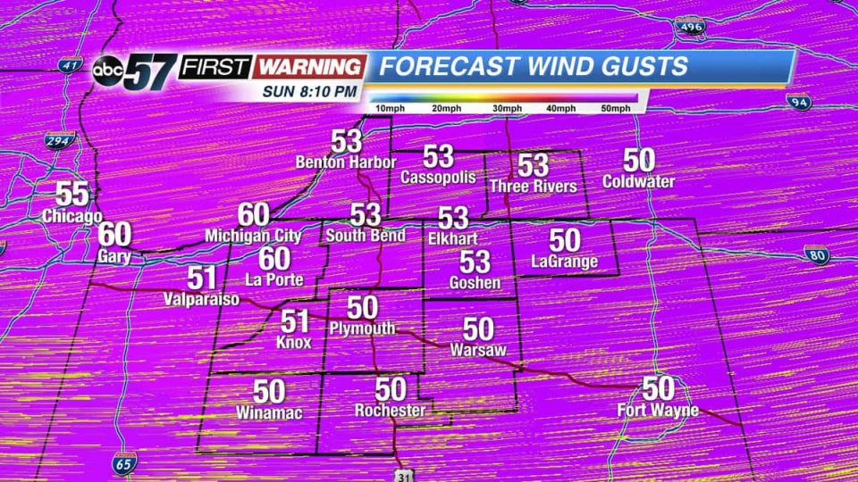
Gusts of 45-60 mph will be possible in the afternoon. Wind speeds will calm down into Monday morning as colder air and lake-effect snow showers could fire up.
HIGH WIND WARNING IN EFFECT FROM
SUNDAY THROUGH EARLY MONDAY MORNING...

HAZARDOUS WEATHER...

 * Sustained west winds of 30 to 40 mph, with frequent gusts of 45
to 60 mph are expected to start
Sunday morning persist into
the overnight hours of Monday
morning.

 * Brief periods of sustained winds to 45 mph and wind gusts to 60
   mph will be possible, especially during the Sunday morning
   hours.

IMPACTS...

 * Downed tree limbs and small trees could block roads and lead
   to power outages as well as cause minor structural damage.

 * Driving in high profile vehicles, especially on north-south
   roads could become hazardous.

 * Unsecured outdoor objects will be blown around.

PRECAUTIONARY/PREPAREDNESS ACTIONS...

A High Wind Watch means there is the potential for a hazardous
high wind event. Sustained winds of at least 40 mph...or gusts of
58 mph or stronger may occur. Continue to monitor the latest
forecasts.
Your ABC 57 First Warning Neighborhood Weather Center Forecast:
Sunday: Cloudy with rain showers changing to snow. Very windy with gusts as high as 50-60 mph. High of 37 and falling throughout the day.
Monday: Partly sunny with a chance of morning lake-effect snow showers. Highs in the mid-20s.
⚠️ STRONG WIND FOR SUNDAY⚠️
Bring loose items around your house inside before tonight because things will be VERY WINDY tomorrow. 50 to 60 mph gusts will bring down power lines and tree limbs and will make driving tough! #INwx #MIwx pic.twitter.com/dyK3SonTlT
— Alex Countee (@alexcabc57) February 23, 2019
Quiet tonight, rain chances increase Sat afternoon-evening and warmer. Turning colder Sunday and very windy w/ gusts to 50-60 mph. pic.twitter.com/jUuQCgmxbk
— NWS Northern Indiana (@NWSIWX) February 22, 2019