
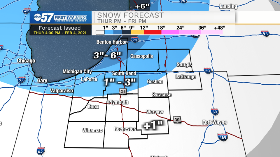
Wet snow, wintry mix then a quick fall in temperatures into Friday morning. A slushy (wet) snow freezing to the roads Friday morning is the main concern as temperatures drop into the teens quickly after midnight.
Bitter cold and a snowy pattern will persist through the weekend and next week. Temperatures only get colder, highs in the teens and lows in the single digits, nearing zero. Areas due east of the lake could see nearly continuous, light lake effect snow showers over the next week. The time of most likely snow accumulation for many, are Sunday night and Monday night, with Tuesday morning possibly the greatest impact. With frigid temperatures every flake will stick. The deep freeze lasts into next weekend.
Your ABC 57 First Warning Neighborhood Weather Center Forecast:
Friday: Mostly cloudy. Temperatures falling from 18.
Saturday: Mostly cloudy. High 14.
Sunday: PM Snow showers. High 12.
Monday: PM Snow showers. High 18.