
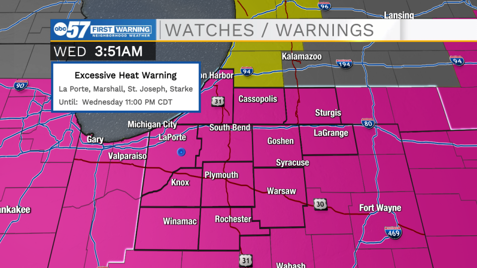
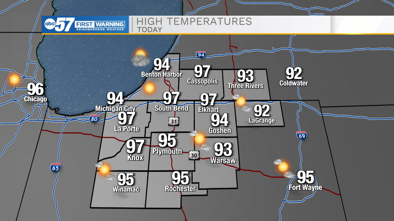
It is a very warm start to the day with temperatures only dropping into the 80s. Highs this afternoon with again return to the mid to upper 90s under sunny skies. This heat mixed with the humidity will put the heat index back into the triple digits. This has prompted yet again another Excessive Heat Warning for all of Michiana. Our next cold front will arrive tonight bringing a slight chance for a few showers and isolated thunderstorms along with it. Once the front clears, cooler air will move into Michiana. Temperatures Thursday afternoon will top out in the lower 90s, Friday the lower 80s, then Saturday the upper 70s. With the dryer air in place, it will be a beautiful weekend ahead for us here in Michiana. Father’s Day high temperatures will hit the mid 80s. Next week the 90s return to the forecast, and with the warmer air will come more chances for showers and thunderstorms.
Your ABC 57 First Warning Neighborhood Weather Center Forecast:
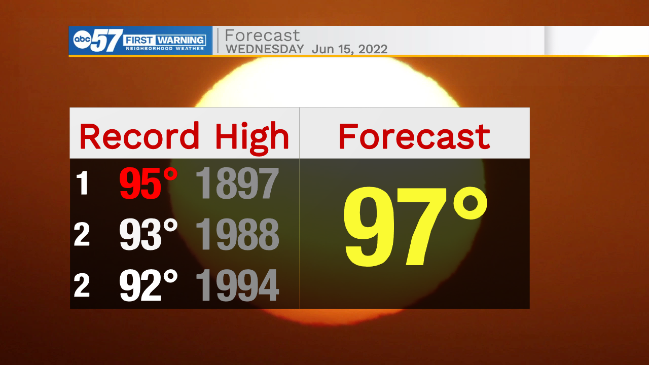
Wednesday: Extreme Heat. High 97.
Wednesday Night: Isolated showers/storms. Low 75.
Thursday: Mostly sunny. High 90.
Friday: Mostly sunny. High 80.