
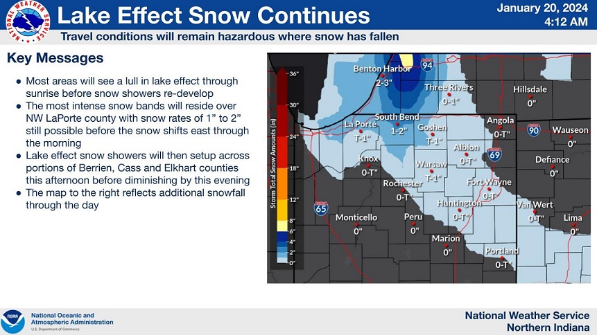
Bands of snowfall are staying a bit further west this morning – over LaPorte Co. – but counties still under a Winter Storm Warning (LaPorte, Berrien, Starke, St Joseph IN, and Marshall Co.) will continue to see the chance for snow showers into Saturday afternoon. This region could see up to an inch of additional snowfall, but higher totals locally are possible, especially in Berrien County.
Snow chances taper off throughout the day, mostly wrapping up by this evening, but travel impacts will extend through the entire weekend. Tomorrow will be dry with sunshine returning but be prepared for cold temperatures topping out in the upper teens before we warm up again to milder temperatures Monday.
Looking ahead to our next chance of impactful weather, freezing rain will be possible Monday night heading into Tuesday.
Saturday: Snow, tapering by the evening. Cloudy. High 20.
Saturday Night: Clouds early, clearing late. Low 0.
Sunday: Mostly sunny. High 18.
Monday: PM wintry mix (freezing rain possible). High 33.