
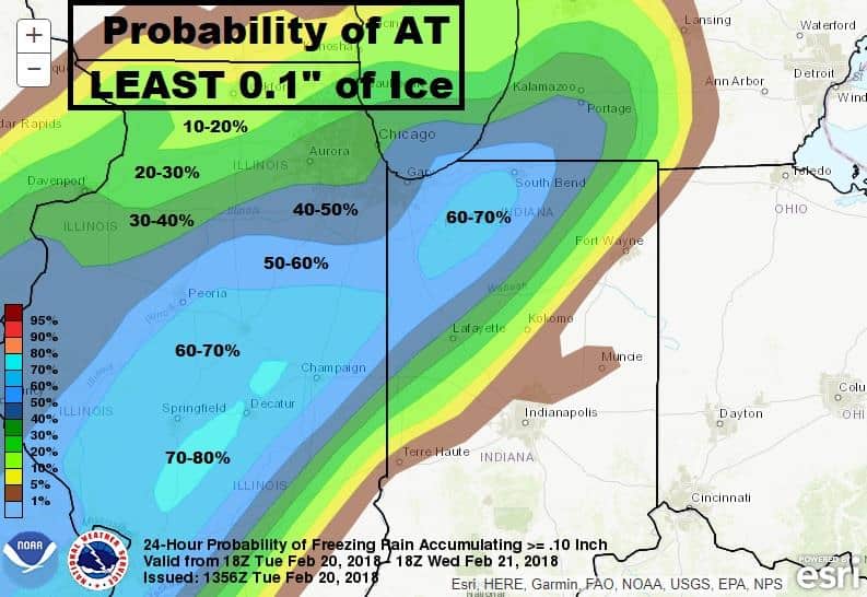
(ABC 57 Meteorologist Emily Kennedy) Rain continues this morning and temperatures remain steady through much of the morning. Rain changes over to a wintry mix which could make for some slick spots on the roads where temperatures fall below freezing. This system finally moves out by late morning leaving the rest of the day much quieter.
Flooding concerns continue for the next couple days as river levels continue to rise; some even breaking record levels. Waters are expected to finally begin to recede Saturday.
We’ll see a few breaks of sunshine Thursday but more rain chances return for parts of Friday and Saturday. Temperatures level back out above average with a quiet and sunny start next week.
Wednesday: AM wintry mix, highs in the middle to lower 30s.
Wednesday Night: Partly to mostly cloudy, low of 26.
Thursday: Partly to mostly cloudy, high of 42.
Friday: Morning rain showers, highs in the mid-40s.
ABC 57 Meteorologist Emily Kennedy has more on this system in the video below: