
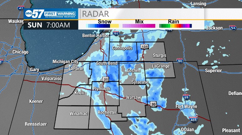
(Amber Twardy/ABC 57 Meteorologist) Lake effect snow has made roads slippery in many areas with localized higher snow totals particularly across northern Michiana. We have been under a winter weather advisory since Saturday night that will continue through 1 p.m. on Sunday. Visibility will be reduced in areas as snow continues to fall this morning.
Snow showers will be diminishing through the late morning. We dry out this afternoon with cloudy skies on the way. Temperatures today will top out in the upper 30’s. We’ll stay dry through Monday, but a rain/snow mix returns Tuesday that lasts into Thursday morning. Keep your winter coat handy – high temperatures stay chilly through the 10-day forecast. The warmest day will be tomorrow with highs in the lower 40’s.
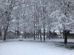
Snow really dumped across St. Joseph Co in the early morning.
Big numbers, but not a big impact, at least as far as travel is concerned. Timing early Sunday and the warm ground helped a lot. #inwx pic.twitter.com/sJtfcQoMUL
— Tom Coomes (@TomCoomes) November 13, 2022
Your ABC 57 First Warning Neighborhood Weather Center Forecast:
Sunday: Snowy morning. Cloudy afternoon. High 38.
Sunday Night: Mostly cloudy. Low 25.
Monday: Partly cloudy. High 42.
Tuesday: Rain/snow showers. High 40.